.jpg")
Opening hours:
closed
Difficulty:
easy
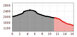
Length:
3.3 km
Elevation uphill:
36 m
:
Style: Skating, Classic
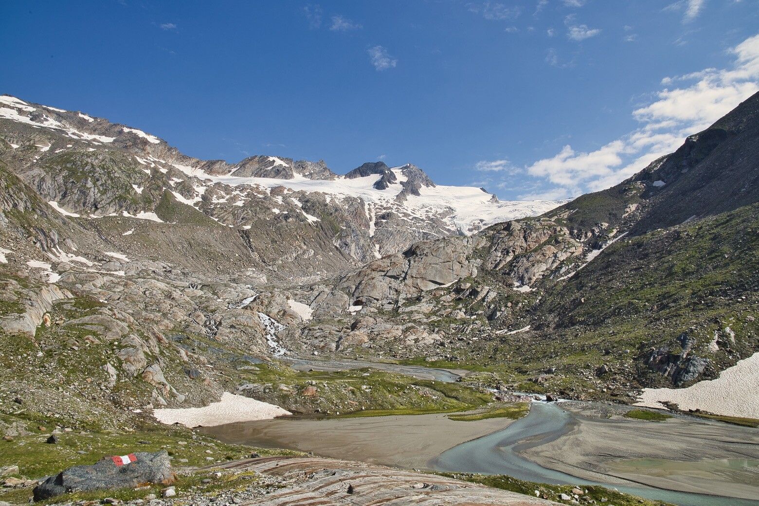
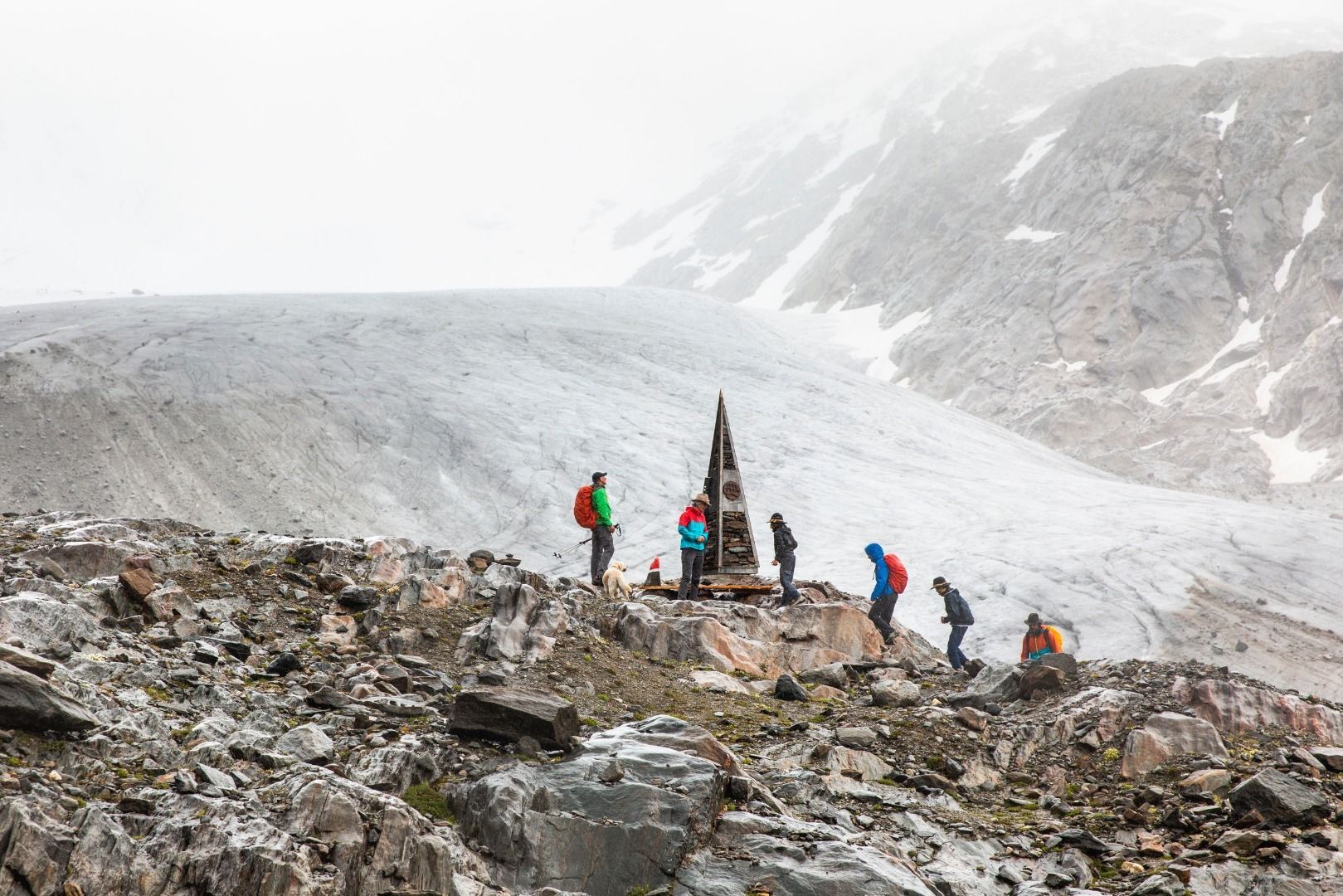
Don't be surprised if you feel very solemn. You are approaching the birthplace of your heroine, the Isel. At the top, on the glacier tongue, you can feel her vulnerability.
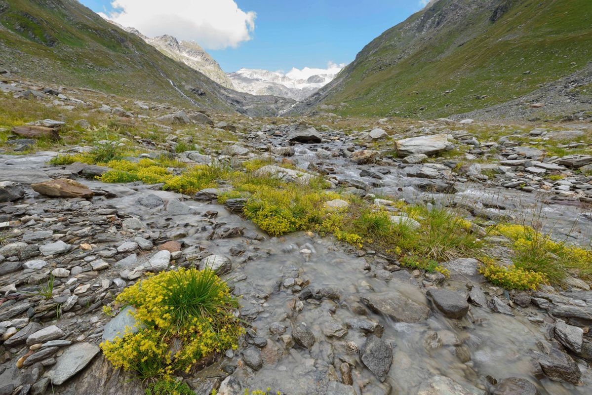
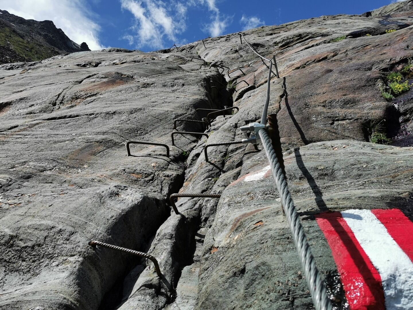
The last stage is technically more demanding, but hardly reaches beyond a medium level of difficulty. The valley turns north towards the Großvenediger massif. Initially flowery meadows, later - where the Umbalkees has retreated due to global warming - rougher and rockier. The terrain becomes steeper at a step where the glacier used to protrude. The Isel shrinks to a stream. At just over 2,500 meters, the tongue of the Umbalkees, the source of the Isel, is reached. It is surrounded by high three-thousand-metre peaks, including the almost 3,500-metre Dreiherrenspitze. Long descent to the Ströden parking lot on the same route. From there (depending on the time of day, only from Hinterbichl) the 951 bus takes you back to Lienz.
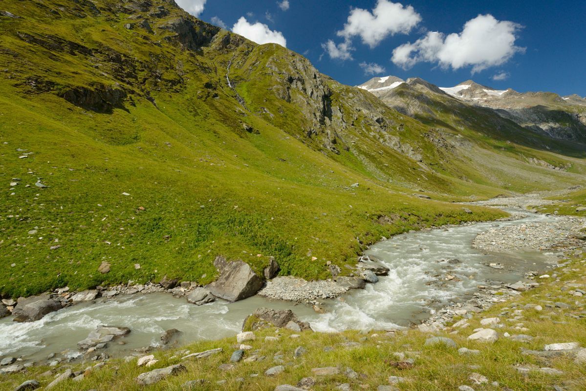

The hut Clarahütte is already in the middle of the alpine wilderness of the Hohe Tauern National Park. The mighty Rötspitze (3495m) towers over the valley.
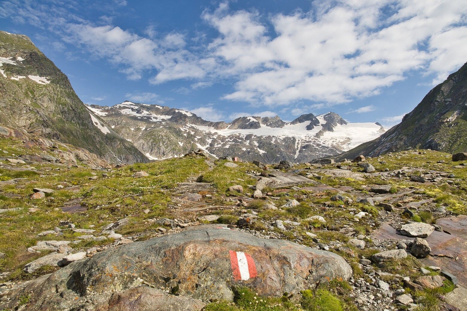
The Iseltrail first runs across wide, flowery alpine meadows. Over a steep step, which was covered by glaciers only a few decades ago, you reach the arctic climate zone. You finally reach the "birthplace" of the Isel at the glacier tongue of the Umbalkees, below the Dreiherrenspitze (3499m).
The way back to the parking place Sröden (free bus connection) should not be underestimated: For the 12 kilometres and 1000 metres of altitude difference on the way down, you should calculate a good three hours of walking time.


")


