Arrival by public transport
Hiking bus to Hoch-Imst
information on the current bus times can be found here:
Startseite • Verkehrsverbund Tirol (vvt.at)
"Climb the peaks: adventurous hike to the Platteinspitze"
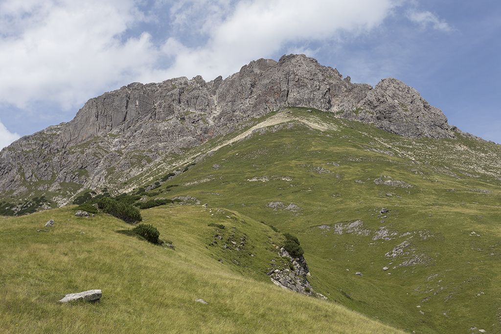
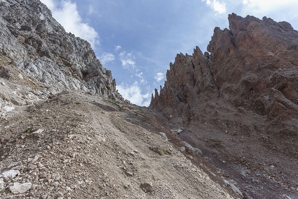
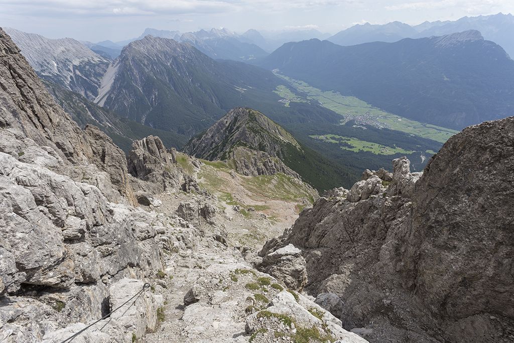
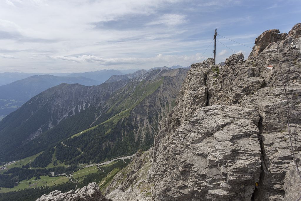
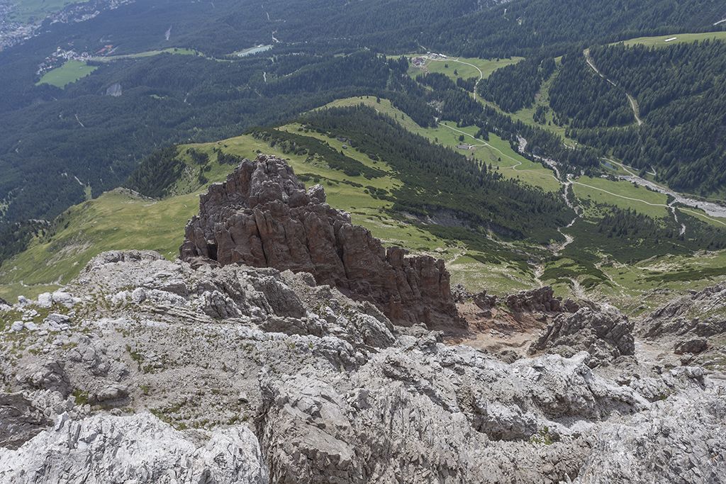
Embark on a challenging adventure and explore the majestic Platteinspitze, which beckons with its imposing presence and breathtaking views. Your starting point is the Imter Bergbahnen middle station, from where your journey begins. The trail takes you at a leisurely pace to the idyllic Latschenhütte mountain hut, where you can take a well-earned break to prepare for the ascent. From here, the trail ascends, initially through dense forest, until you leave the tree line behind you shortly before the Narrenkreuz and are rewarded with a breathtaking view. You hike up across the wide plateau meadows until you finally reach the imposing rocks. From this point, the trail becomes more challenging. First you cross a gravel section before you reach rocky terrain. A head for heights and surefootedness are essential here, as the path to the summit is secured with a wire rope.
Refreshment stops: Untermarkter Alm, Latschenhütte
Highlights: Jägersteig, Platteinwiesen, Alpine Coaster.
Hiking bus to Hoch-Imst
information on the current bus times can be found here:
Startseite • Verkehrsverbund Tirol (vvt.at)
Parking lot Imster Bergbahnen


")
