Mountain hikes Steinberg - Guffert - Steinberg

Steinberg am Rofan /
Difficulty ratings: difficult
Route length: 10 km
Duration: 6:30 h

The hike up the Guffert, Steinberg's local mountain, is a rewarding adventure with breathtaking views and a challenging alpine experience.

Tour character

Demanding mountain tour with magnificent views of the Guffert. Ascent via a steep path and later over rocky high fields and mountain pines, before the rocky ridge secured by a wire rope leads to the summit.

Tour information

  • Requirement: difficult
  • Length: 10 km
  • Duration: 6:30 h
  • Elevation uphill:1195 hm
  • Elevation downhill:1195 hm
Highest point 2,195 m

Starting point

Steinberg am Rofan, inn Gasthof Waldhäusl

Finishing point

Steinberg am Rofan, inn Gasthof Waldhäusl

Best time of year

  • January
  • February
  • March
  • April
  • May
  • June
  • July
  • August
  • September
  • October
  • November
  • December

Wegbeschaffenheit

hiking trail, short distance which is secured with a steel rope

Ausrüstung

Sturdy boots (ankle-high hiking boots), weather appropriate clothing, enough to eat and drink. Telescopic hiking poles are recommended.

Description

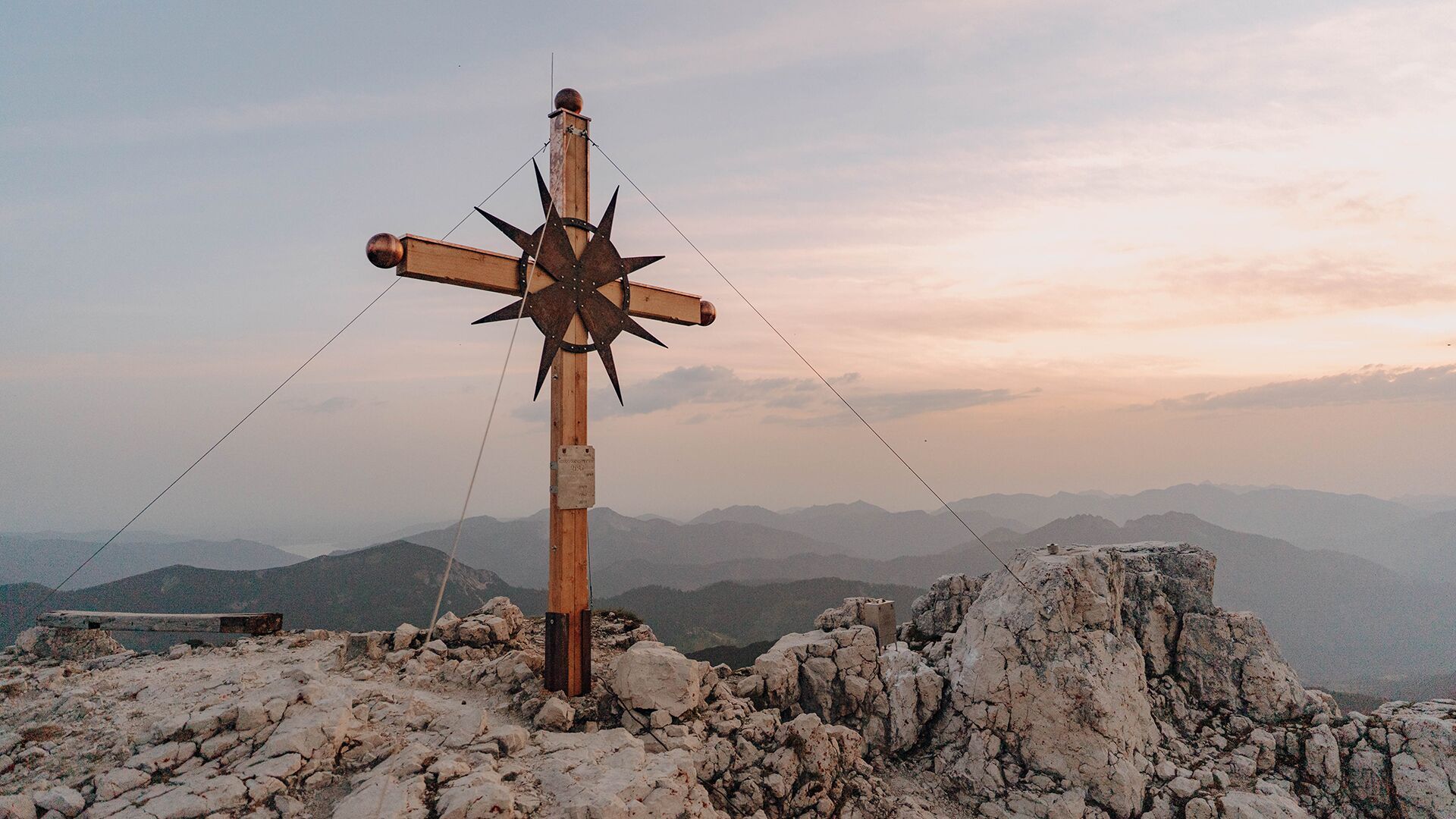
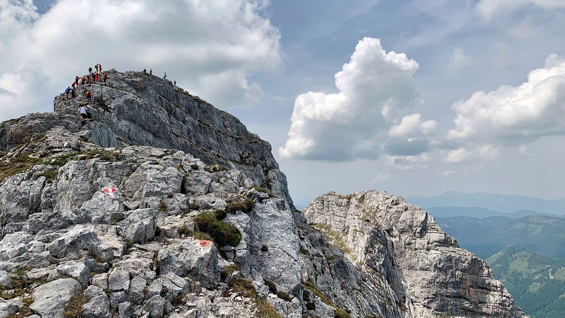
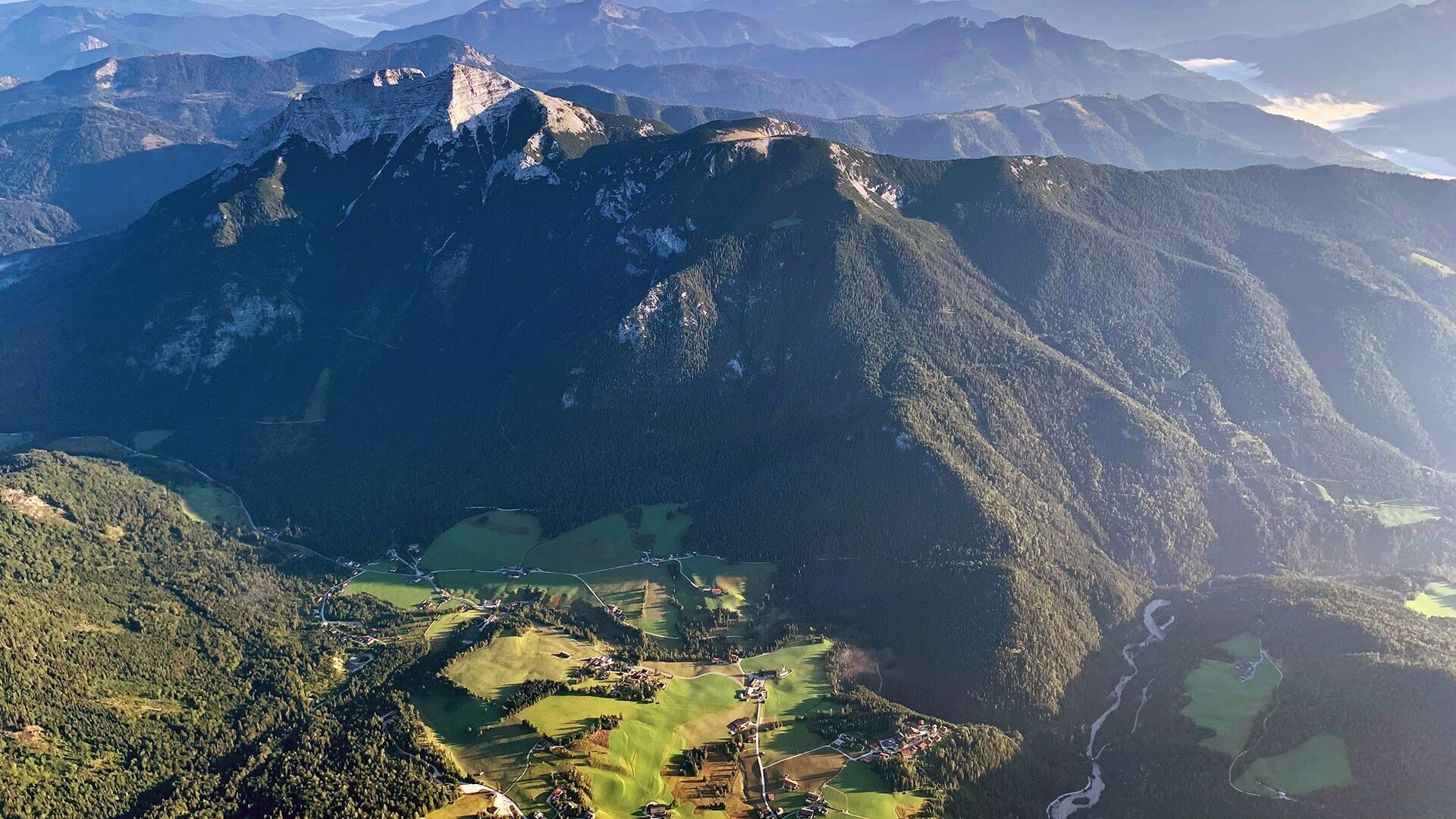
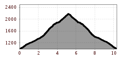
From the car park at the inn "Gasthof Waldhäusl", climb the steep trail to the Guffert. At an elevation of ca. 1,800 metres, you can make a detour to the Schmiedtquelle (dried up spring). Follow the Guffertsteig as it climbs over rocky terrain between mountain pines. Continue along the ridge which is secured with a steel rope until you reach the summit (2,195 metres). The return is via the same route.

Getting here

  • Arrival by public transport

    Exit bus stop: Steinberg a. R. Abzw Waldhäusl

  • Parking

    Car park Waldhäusl in Steinberg am Rofan (paid parking lot)

  • Contact

    Steinberg - Guffert - Steinberg
    ****

More tours in the surrounding area

Newsletter

The mountain is calling? So does our newsletter!

In our weekly newsletter we reveal the best holiday tips for Tyrol.