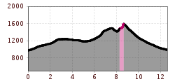
Mountain hikes Spitzstein Circuit

Erl /
Difficulty ratings: difficult
Route length: 13 km
Duration: 5:30 h

If you spend the night at the Spitzsteinhaus, it is only an hour to the great sunrise or sunset experience on the Spitzstein summit. However, the summit tour also has a lot to offer at normal times of day.

Tour character

Interesting tour to a summit with great views in the Chiemgau Alps. The views extend across the Alpine foothills to the Hohe Tauern. The difficulty and length of the tour are easy to control, as there are various start/parking and route options. The Nordwandsteig increases the level of difficulty with secured sections, the normal route from the Spitzsteinhaus leads to the summit with summit chapel without difficulty. Take care on the normal route when it is wet, as the surface can be very slippery. The Spitzstein is also known as the Blumenberg.

Tour information

  • Requirement: difficult
  • Length: 13 km
  • Duration: 5:30 h
  • Elevation uphill:770 hm
  • Elevation downhill:770 hm
Highest point 1,566 m

Starting point

Hiking parking lot Erlerberg

Finishing point

Hiking parking lot Erlerberg
  • Fitness level 4 / 6
  • Technique 4 / 6

Features

  • Circular route

Best time of year

  • January
  • February
  • March
  • April
  • May
  • June
  • July
  • August
  • September
  • October
  • November
  • December

Description

Starting from the Erlerberg parking lot, this tour offers stunning views of the Bavarian Alpine foothills and impressive vistas of the Inn Valley. The route first skirts the summit to the west before ascending the Spitzstein via the North Face Path. The North Face Path is not a classic via ferrata; it is partially secured with ropes and classified as a black (difficult) mountain trail. It is recommended only for experienced and sure-footed mountain hikers. Since it is predominantly on the north side and runs through a gully, extra caution is advised in wet conditions or when residual snow is present. For this reason, it is best to attempt this route in late spring or later.

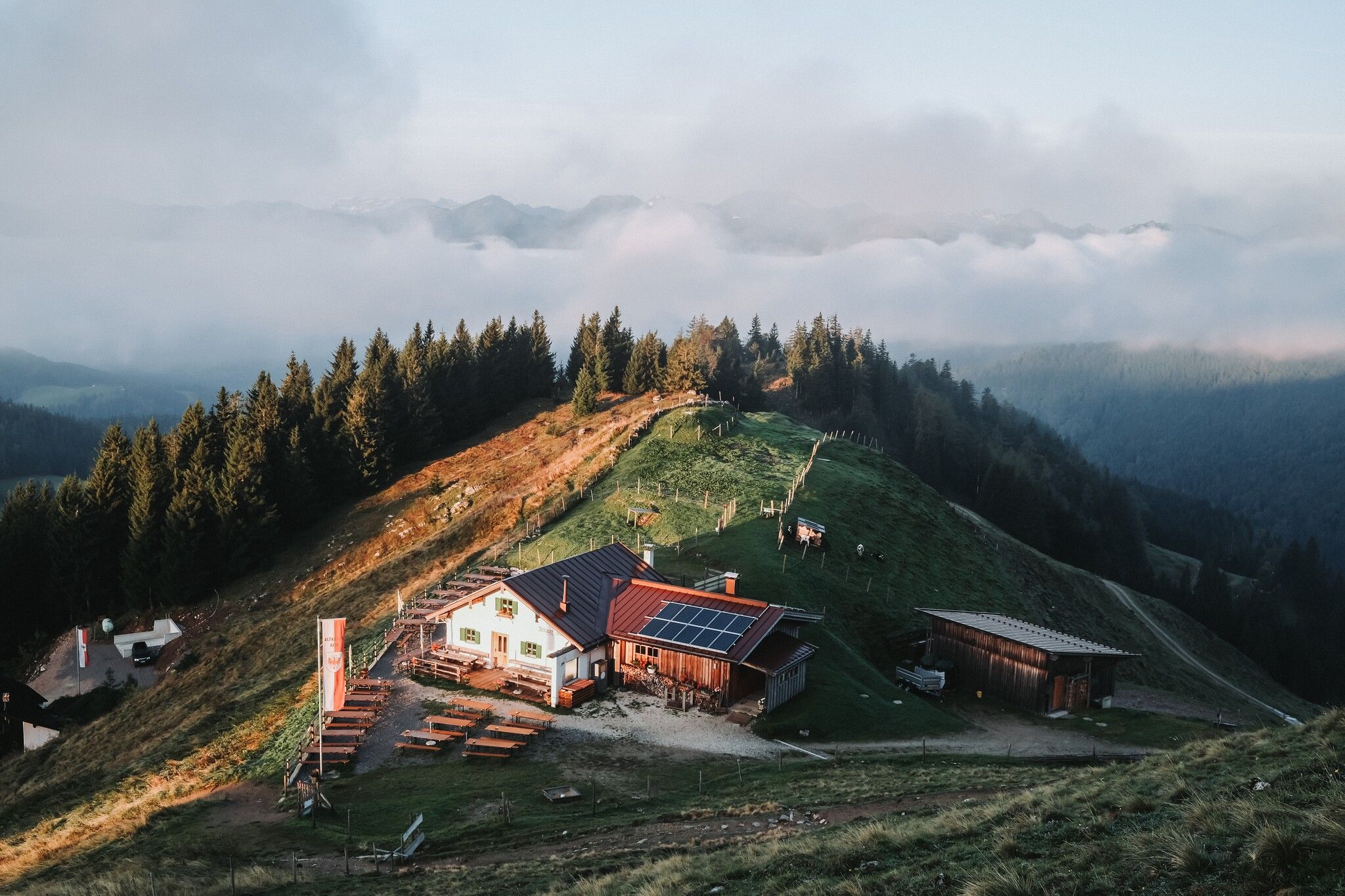
Descending from the summit, the trail follows a moderate grassy slope. The Altkaser Alm and Spitzsteinhaus offer rest stops along the way. The descent continues across alpine meadows, providing almost continuous views of the Kaiser Mountains, and returns to the parking lot.

Getting here

  • Arrival by public transport

    With bus line 4036, you can travel to the "Erl Dorf" stop. From there, the ascent must be completed on foot. To reach the starting point, this involves an additional 490 meters of elevation, 5.2 kilometers, and an ascent time of approximately 2 hours.
    With the KufsteinerlandCard, bus travel within the region is free.

  • Parking

    Hiking parking Erlerberg (free of charge) or Gogl Alm (paid).

  • Contact

    Spitzstein Rundtour

    ****

More tours in the surrounding area

Newsletter

The mountain is calling? So does our newsletter!

In our weekly newsletter we reveal the best holiday tips for Tyrol.

Protected by