
Difficulty:
medium
Length:
7.0 km
Duration:
3:30 h
Elevation uphill:
735 m
Where smugglers used to take their goods across the border on secret trails, today people live out their boundless wanderlust. A varied four-day tour through wonderful mountain nature.
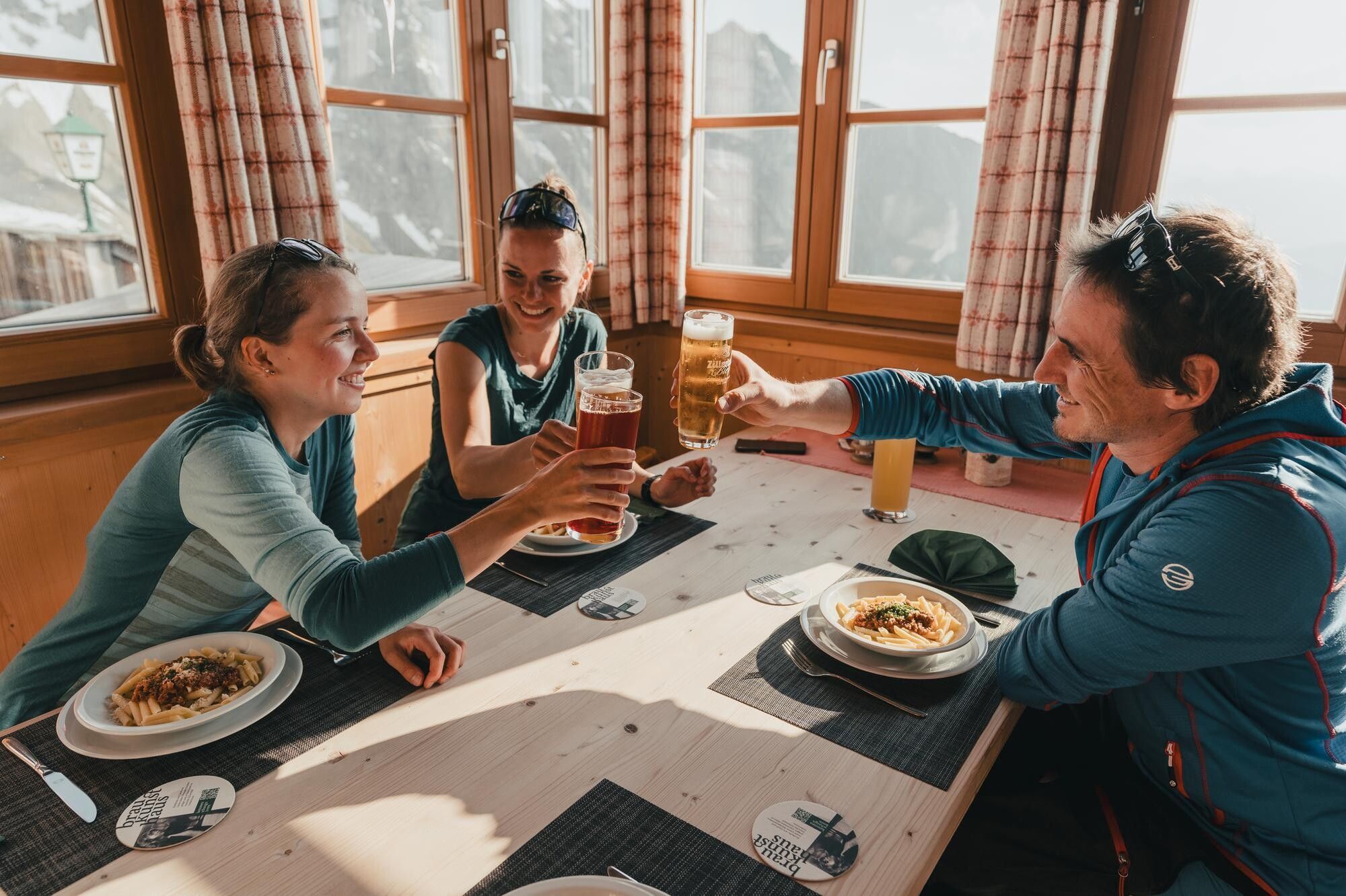
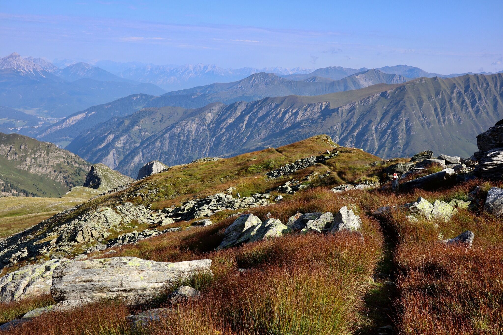
This beautiful multi-day tour runs along red and black, i.e. moderately difficult to difficult mountain trails. Each stage also offers one or more variants that differ in length and difficulty from the "normal route". All variants require fitness and mountain experience and provide a wonderful experience of nature.
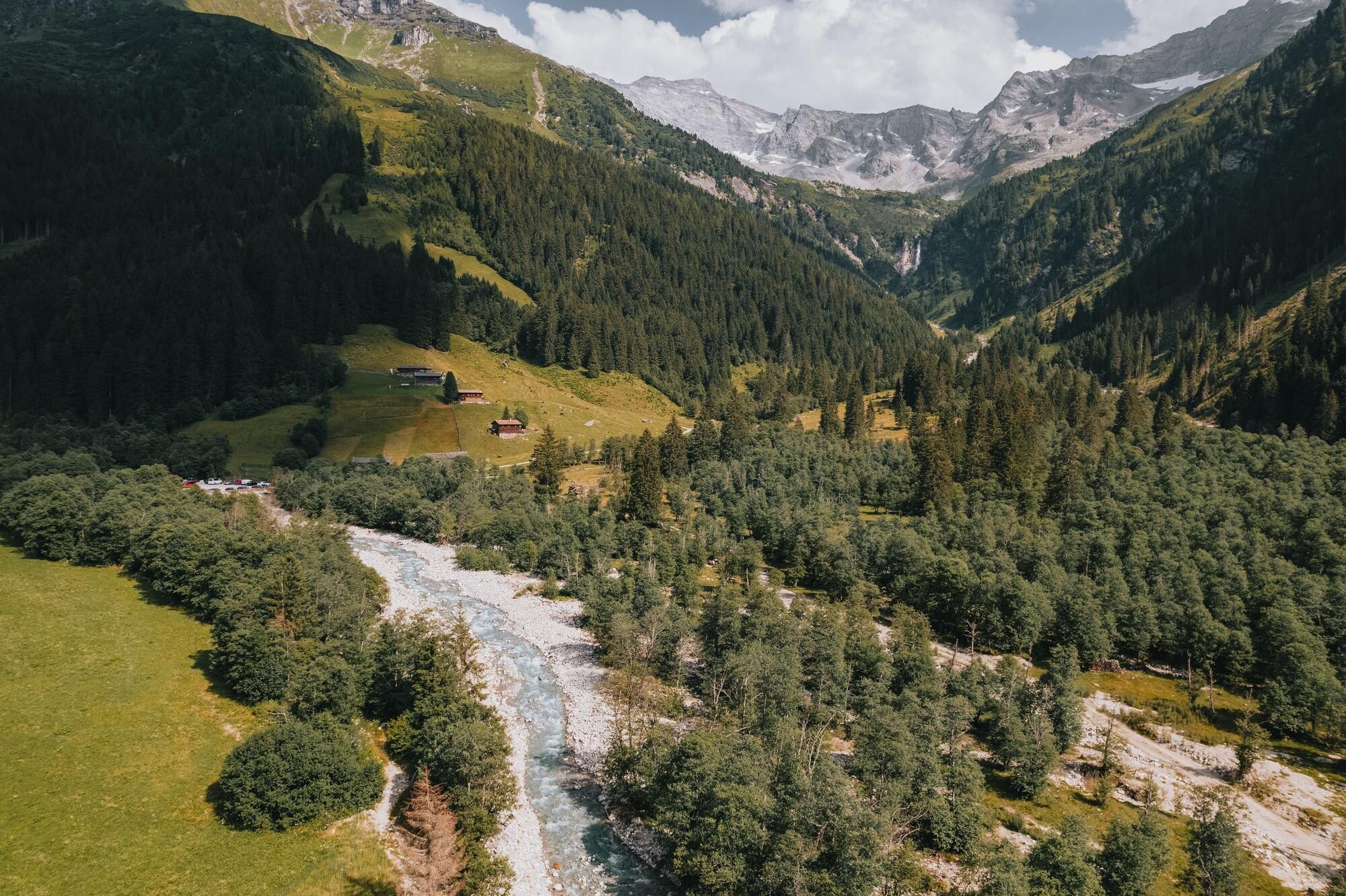


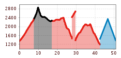
Stage 1: St. Jodok (1,130m) - Vals Touristenrast (1,345m) - Geraer Hütte (2,324m)
Walking time: approx. 3.5 hours, distance: 7 km, 1,000 m difference in altitude ↑
From St. Jodok, take the public bus (exit Touristenrast) or your car (large parking lot "Nockeralm" / parking lot Geraer Hütte) to the starting point.
From the Touristenrast, follow the farm road no. 502 to the Geraer Hütte material cable car. From here, a trail (no. 502) leads in numerous and well laid out hairpin bends first through forest and later over open terrain up to the Geraer Hütte (2,324 m).
Stage 2: Geraer Hütte (2,324m) - Pfitscherjochhaus (2,276m)
Walking time: 5.5-6 hours, distance: 10 km, 800 m ↑, 850 m ↓
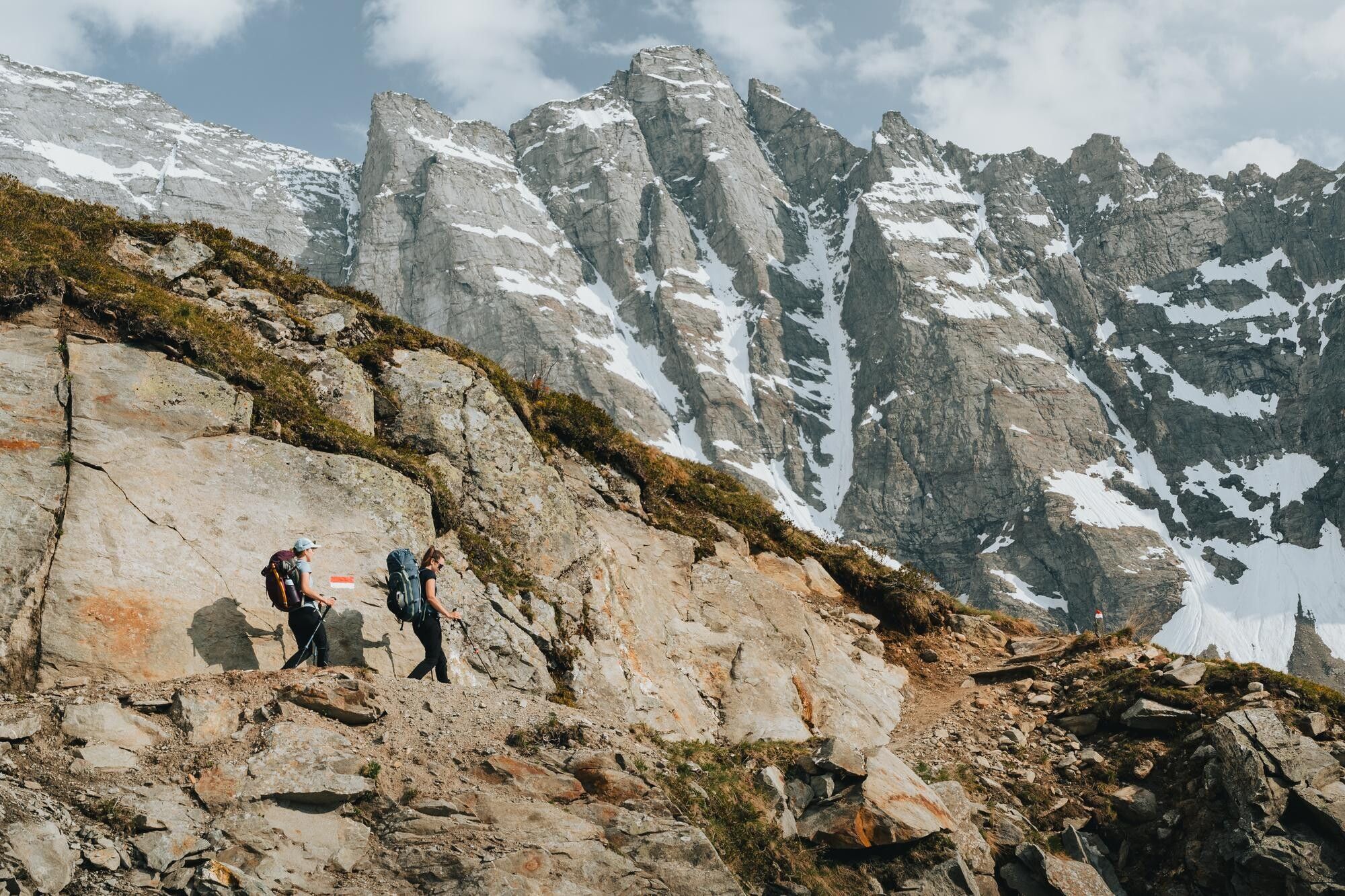
Trail no. 502 leads you south-east through a wide gravel cirque. You are framed by the mighty and imposing rock faces of Fußstein and Schrammacher. Gradually you come closer to the iron framework of the former molybdenum mine, visible from afar. The path now leads through steeper terrain of slippery and fine scree before you reach the Alpeiner Scharte.
Follow the path down into the Zillertal valley in pleasant serpentines. Follow the trail markings 528 (please ask the hut warden at the Geraer Hütte about the composition of the trail and the ideal variant, there are several options here) through scenic highlights to the Pfitscherjochhaus. The trail leads around two mountains at approx. 2,400 m and crosses two larger streams, dropping slightly before you tackle the final ascent to your destination today.
Stage 3: Pfitscherjochhaus (2,276m) - St. Jakob, Pfitsch (1,449m)
Walking time: 5 hours, distance: 11 km, 250 m elevation gain ↑, 1,075 m elevation gain ↓
Follow the path back to the former border crossing and turn off here towards Landshuter Europa-Hütte. Without any technical challenges, you hike through a Mediterranean landscape. Gradually, the landscape becomes more rugged again and you cross a few streams that flow peacefully into a moorland landscape below you. Before the final ascent to the Europahütte (which is expected to be completely rebuilt in 2025/2026), you descend to St. Jakob in Pfitschtal, your destination for the day.
Stage 4: St. Jakob, Pfitsch (1,449m) - Sattelbergalm (1,637m)
Walking time: 5.5 hours, distance: 11 km, 850 m ↑, 575 m ↓ (plus transfer time)
You leave the Pfitschtal valley by public transport and travel via Sterzing up to the Brenner Pass (both routes included in the guest card, individual transfer can be booked for a fee of €90)
A beautiful trail starts in the center of Brennero/Brenner and leads you up to a small plateau in steep hairpin bends. From here, follow the now flatter path through the Steinalm area. Between Kreuzjoch and Steinjoch you reach the mountain bike route on the Brenner border ridge. Here you can follow the forest path or the gentle ups and downs of the Tiroler Höhenweg to the summit of the Sattelberg.
Both options come together at the Sattelberg at 2,115 m and you have reached your last intermediate destination for today. The summit of the Sattelberg lies exactly on the border between Austria and Italy. Before you hike down to the cozy Sattelbergalm (Jubiläumssteig #4), keep to the right of the summit until you see the first markings. Enjoy the end of your smugglers' tour at the Sattelbergalm, where you will spend the last night.


 (1).jpg")
")

.jpg")

.JPG")


