
Opening hours:Open today
Place:Umhausen
:Alpine pasture / hut / mountain restaurant
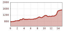
STAGE 2:OETZ –> Weller Bridge –> Habichen Lake –> Elisabeth's Height –> Tumpen –> Engelswand –> Lehn Platzl –> Church of Mary Snow –> Farstrinne –> Wienersteig –> Steppsteig –> Stuibenfall –> NIEDERTHAI


Moderately difficult mountain path; suitable for sure-footed and experienced mountain hikers; good physical condition, mountain experience, and mountain equipment (see under equipment) are necessary. Please pay attention to the current weather report.
Appropriate equipment such as breathable and weather-appropriate outdoor clothing is necessary for all hikes and routes. Carrying a first aid kit, a mobile phone, and possibly a hiking map, as well as sufficient provisions for hikes without the possibility of stops, is necessary.
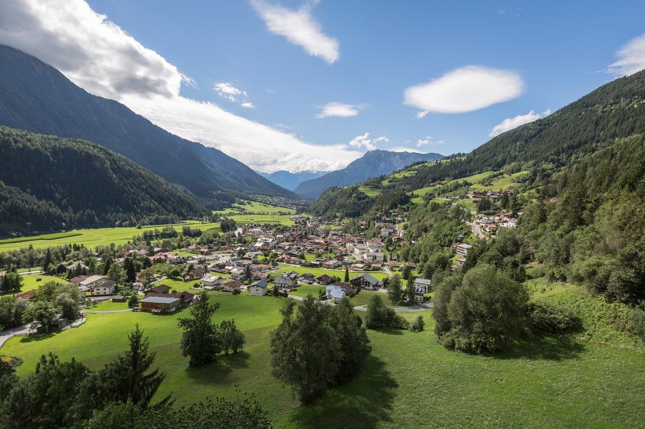
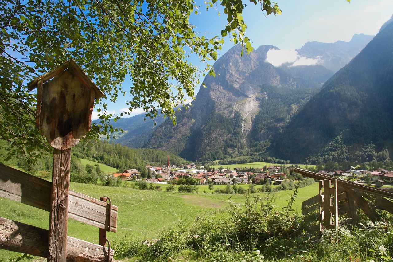
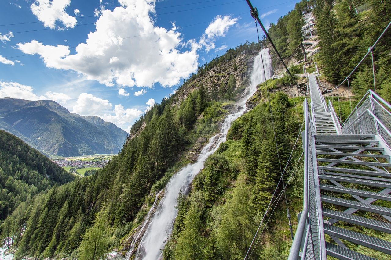
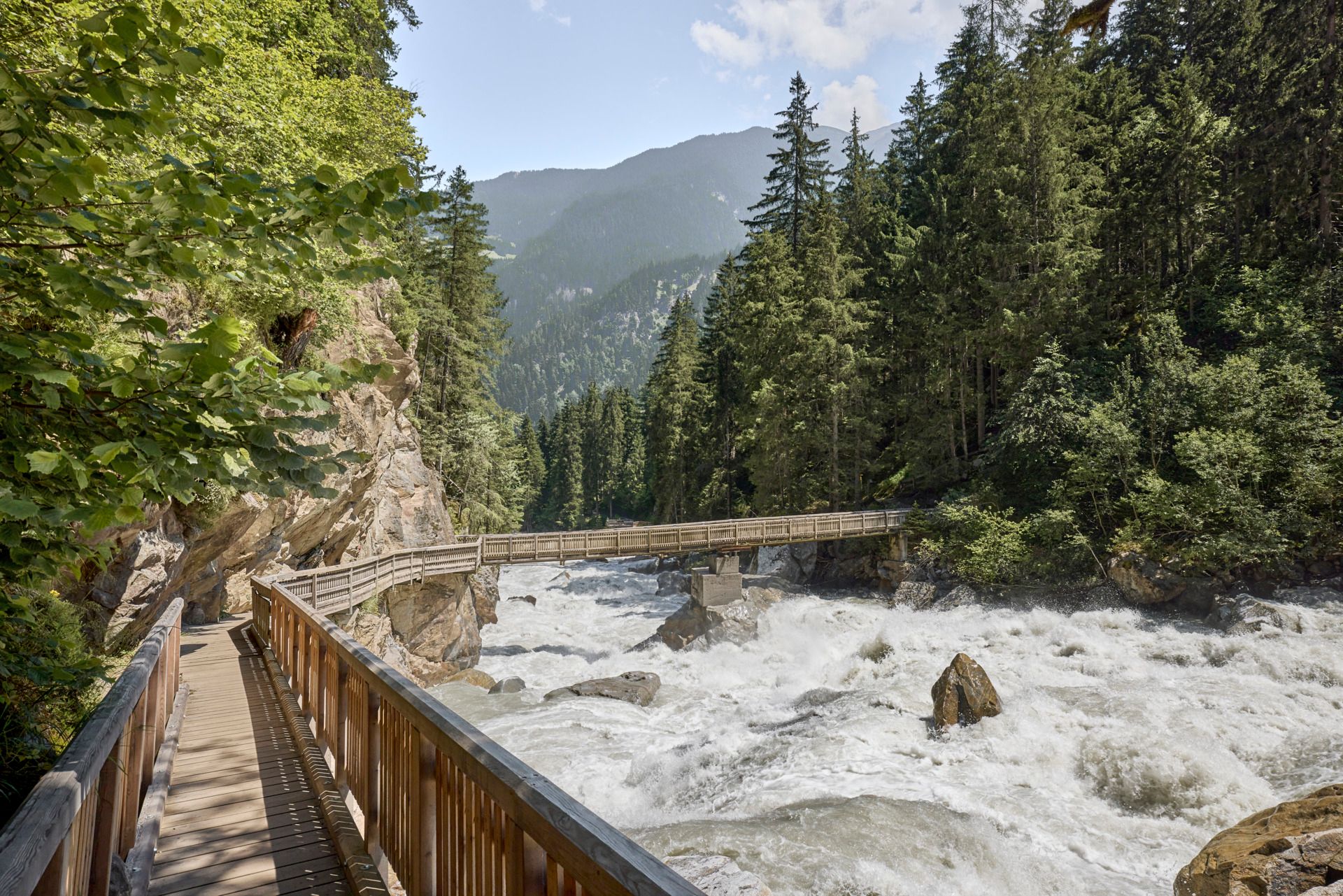
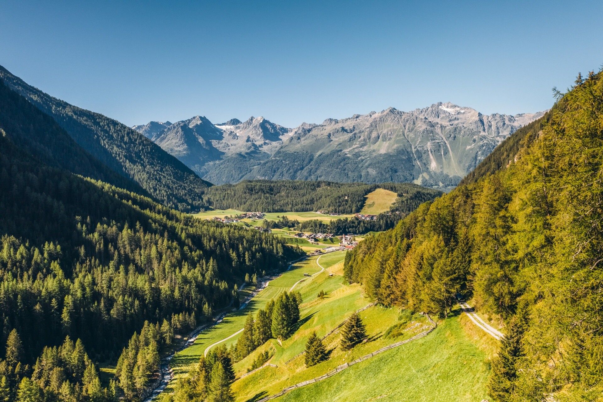
FROM THE QUIET LAKE TO THE TURBULENT WATERFALLHistorical facade paintings shape the appearance of the old town center of Oetz, through which today's stage takes us. It goes through some of the most original places. One of them is the former “ice cellar” of Habichen. Near the small lake fed by cold mountain water, the Habichen Lake, there is a rock slab through which cold air flows via underground tunnel systems.At Tumpen, the Ötztal opens up, blooming wide meadows framed by steep rock walls now accompany the next kilometers. In the middle is a picturesque little church, Maria Schnee, a popular pilgrimage site! From quiet forest and meadow hiking, it continues extremely turbulently; the Stuibenfall, Tyrol's largest waterfall, must still be overcome. Close at hand, the masses of water plunge over the fall, the path and steps construction offer an unforgettable experience. Once at the top, the sunny plateau Niederthai invites you to linger.
Travel comfortably and safely by train to the Ötztal railway station. The final stop or exit point is ÖTZTAL station. Afterwards, you can conveniently and quickly travel through the entire valley to your desired destination by public transport or local taxi companies.
The current bus schedule is available at: fahrplan.vvt.at
The following parking options are available in Oetz:
- Acherkogelbahn car park | paid | camping prohibited
- Rafting entry point car park (at the end of Oetz on the right side) - paid, but limited parking spaces (alternatively Acherkogelbahn 150 m), camping prohibited
- Central car park Oetz | paid
- Overnight parking during multi-day tours: central car park Oetz | The ticket is available at the Oetz information office.


.jpg")


")

.jpg")


