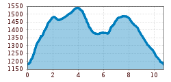
Difficulty:
easy
Length:
573 m
Duration:
0:20 h
Elevation uphill:
12 m
Mythenweg

We hike from the castle pon in Ladis (L009) over the Wasserwandersteig (Water Trail) to Fanggaloch (Tuff grotto) and then continue to the paradise view at Schönegg (L020). From this point walk back and take the first crossing left (L019) until you reach the fountain to Obladis. Follow the Herrenweg trail and the Wodebad pond to the Wodeturm tower (L030) and then take the forest track back to the Wodebad pond and Neuegg with a café. Walk back from Neuegg over the Asterhöfe and the Greitweg to Ladis or take the vehicle track directly to Ladis.