Mountain hikes Mühlenweg - Kollreid, Anras

Difficulty ratings: easy
Route length: 6.7 km
Duration: 2:30 h

Mühlenweg - Kollreid, Anras

Tour information

  • Requirement: easy
  • Length: 6.7 km
  • Duration: 2:30 h
  • Elevation uphill:310 hm
  • Elevation downhill:310 hm
Highest point1,373 m

Starting point

Dorfzentrum Anras

Finishing point

Dorfzentrum Anras
  • Fitness level 2 / 6
  • Technique 2 / 6

Features

  • Circular route

Best time of year

  • January
  • February
  • March
  • April
  • May
  • June
  • July
  • August
  • September
  • October
  • November
  • December

Description

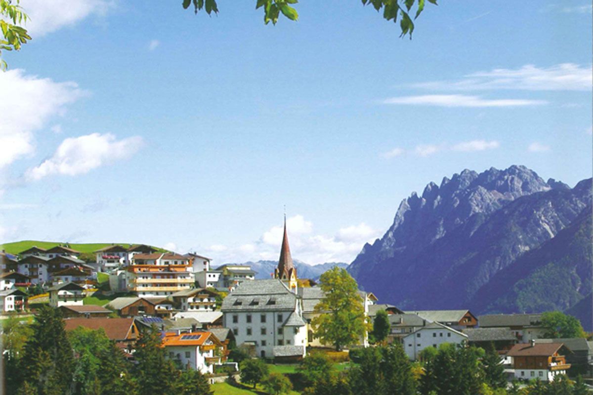
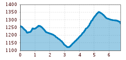
Along the trail between the old farmhouses, keep left until the crossing for Lourdes chapel, continue on the lower forest trail to the St. Antonius pilgrimage church. There in a westerly direction to Mühlbach. A footbridge continues via Mühlbach to Goll, along the forest limits to Kollreid and back to Anras.
 

Getting here

  • Parking

    Parkplatz Anras Zentrum

More tours in the surrounding area

Newsletter

The mountain is calling? So does our newsletter!

In our monthly newsletter we reveal the best holiday tips for Tyrol.