Mountain hikes Kaisers - Halden round

Kaisers /
Difficulty ratings: easy
Route length: 1.8 km
Duration: 0:35 h

The highest municipality in the Außerfern region lies at an altitude of 1522 metres and consists of the hamlets of Kienberg and Boden.

Tour information

  • Requirement: easy
  • Length: 1.8 km
  • Duration: 0:35 h
  • Elevation uphill:45 hm
  • Elevation downhill:45 hm
Highest point 1,553 m

Starting point

Edelweisshaus

Finishing point

Edelweisshaus
  • Fitness level 1 / 6
  • Technique 1 / 6

Features

  • Circular route
  • Suitable for families

Best time of year

  • January
  • February
  • March
  • April
  • May
  • June
  • July
  • August
  • September
  • October
  • November
  • December

Trail condition

Asphalt, gravel path, hiking trail

Equipment

Good equipment is essential for your hike. The following items should definitely be in your rucksack: - Food and drink - Functional clothing for rain, wind and cold - A change of clothes - Sun protection - First aid kit - Mobile phone with a full battery (Euro emergency number 112) - Hiking map or GPS - Hiking poles Nevertheless, the following applies: light luggage is also easier to carry, so you should not weigh down your rucksack with unnecessary ballast. In addition, your hiking equipment should of course also be adapted to your particular hiking tour.

Description

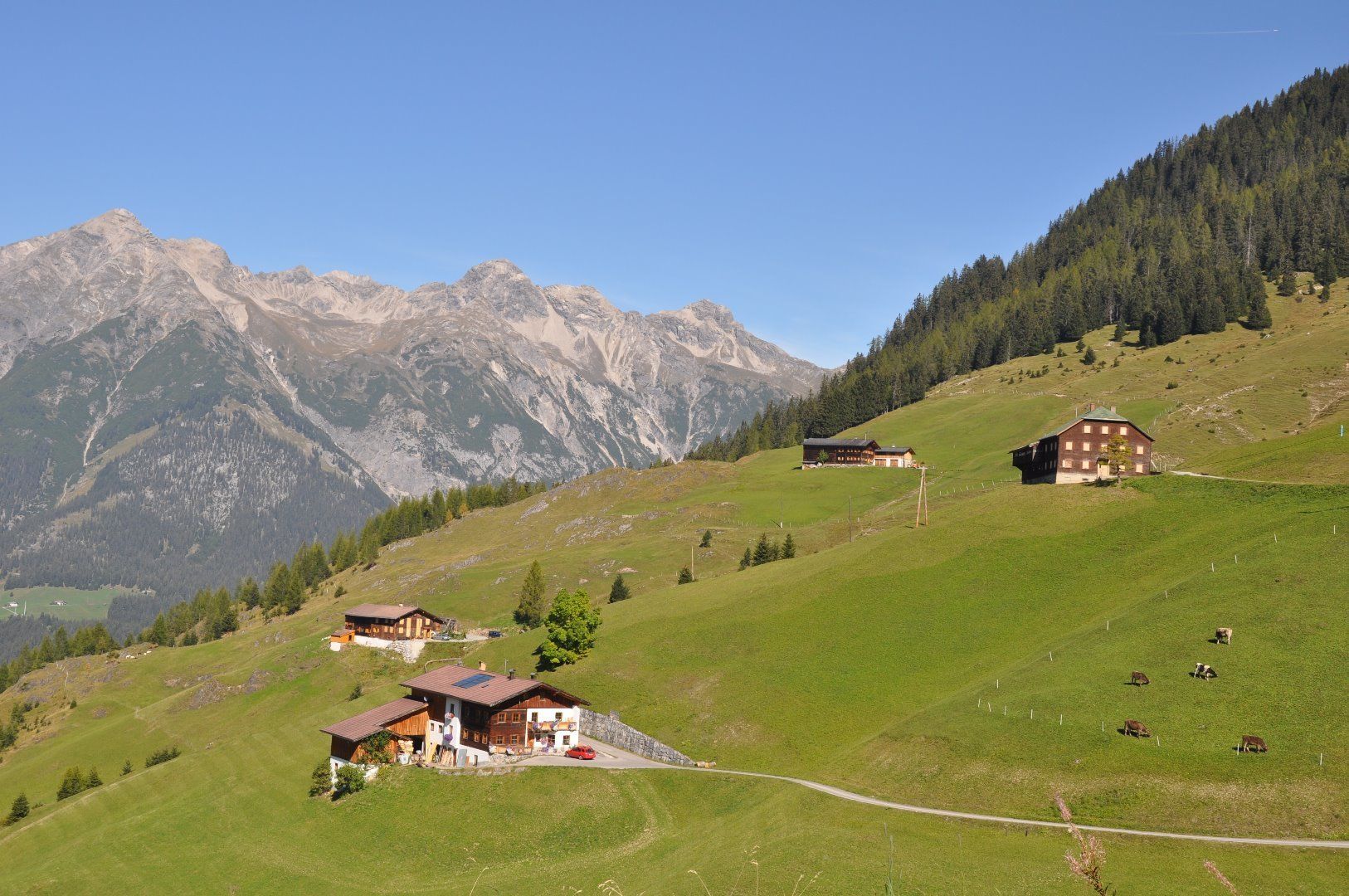
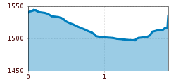
Pass the Edelweisshaus and walk along the footpath to the village road. Once you have passed the last houses, take the path towards Kaisertal and walk down to the road. From there, take the tarmac road towards Vallugablick and back to the Edelweisshaus.

Getting here

  • Arrival by public transport

    Regional bus to Kaisers to the Kaisers Edelweisshaus bus stop

  • Parking

    Kaisers Edelweisshaus

  • Contact

    Kaisers - Halden Runde
    ****

Weather

More tours in the surrounding area

Newsletter

The mountain is calling? So does our newsletter!

In our weekly newsletter we reveal the best holiday tips for Tyrol.