Arrival by public transport
By train to Scharnitz train station, then a 10-minute walk to the starting point at the Nature Park Information Center.
All real-time connections can be found in the route planner.
Did you know that a 7,000-year-old elk skeleton was found above the Pleisenhütte? Although moose no longer exist in Tyrol, you can still see the shaft caves on your tour to the Pleisenspitze.
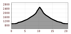
Demanding mountain tour to the striking Pleisenspitze in the Karwendel. From the valley, the trail first leads to the south-facing Pleisenhütte. From here, the ascent becomes steeper and stretches over mountain pines and meadows up to the exposed summit. Sure-footedness, a head for heights and alpine experience are essential on the rocky and sometimes exposed trail. The tour rewards experienced mountain hikers with fantastic views over the Karwendel and the surrounding mountains.


Forest roads, woodland paths, and gravel trails.
All current information about the trail closures in the Region Seefeld can be found here.
Have you been out and about in the Region and discovered a spot that we should rework or repair? Fill out the form "Report a danger zone" and let us know where work is needed.
Sturdy hiking shoes, functional clothing, a backpack, water, snacks, alpine experience, and sure-footedness are necessary for this tour!
Also recommended: a hiking map or GPS, a first aid kit, sun protection, hiking poles, and an emergency blanket.
From the Nature Park Information Center in Scharnitz, follow the Hinterautalstraße about 2 km into the valley, then turn left and hike in several switchbacks to Lablehner. This place, a clearing in the meadow, offers a beautiful view of Brunnstein and the Karwendel Valley.
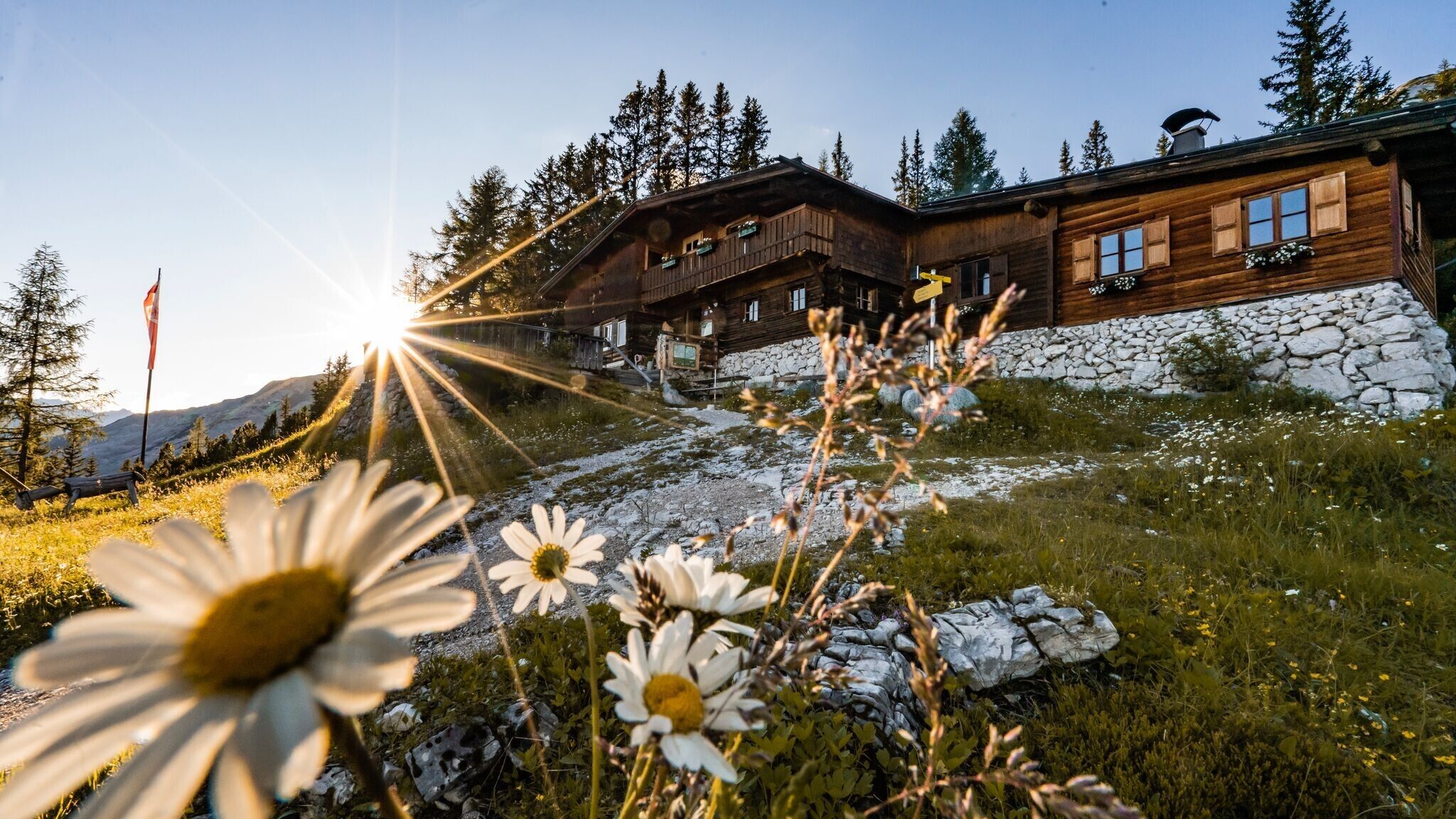
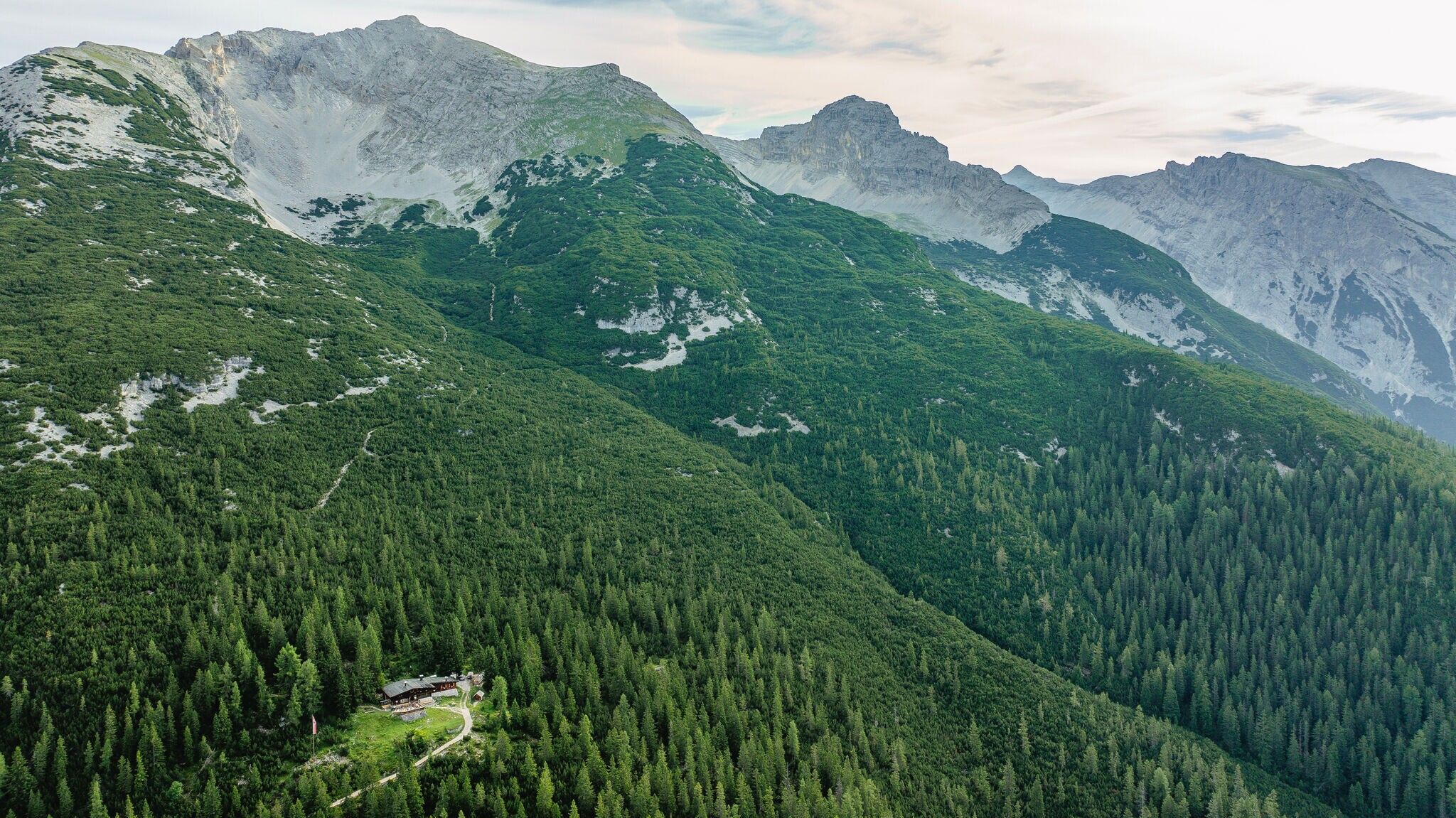
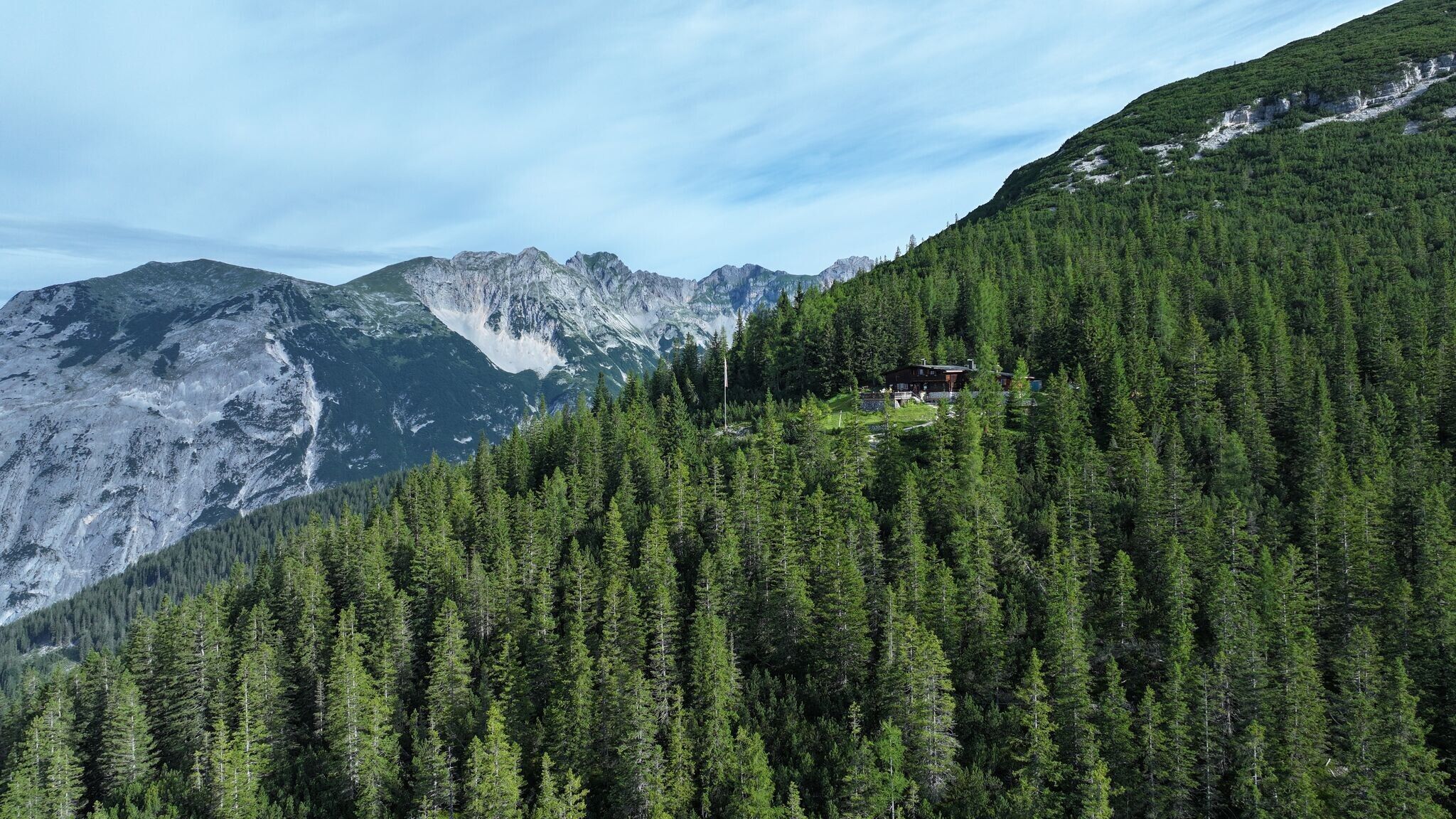
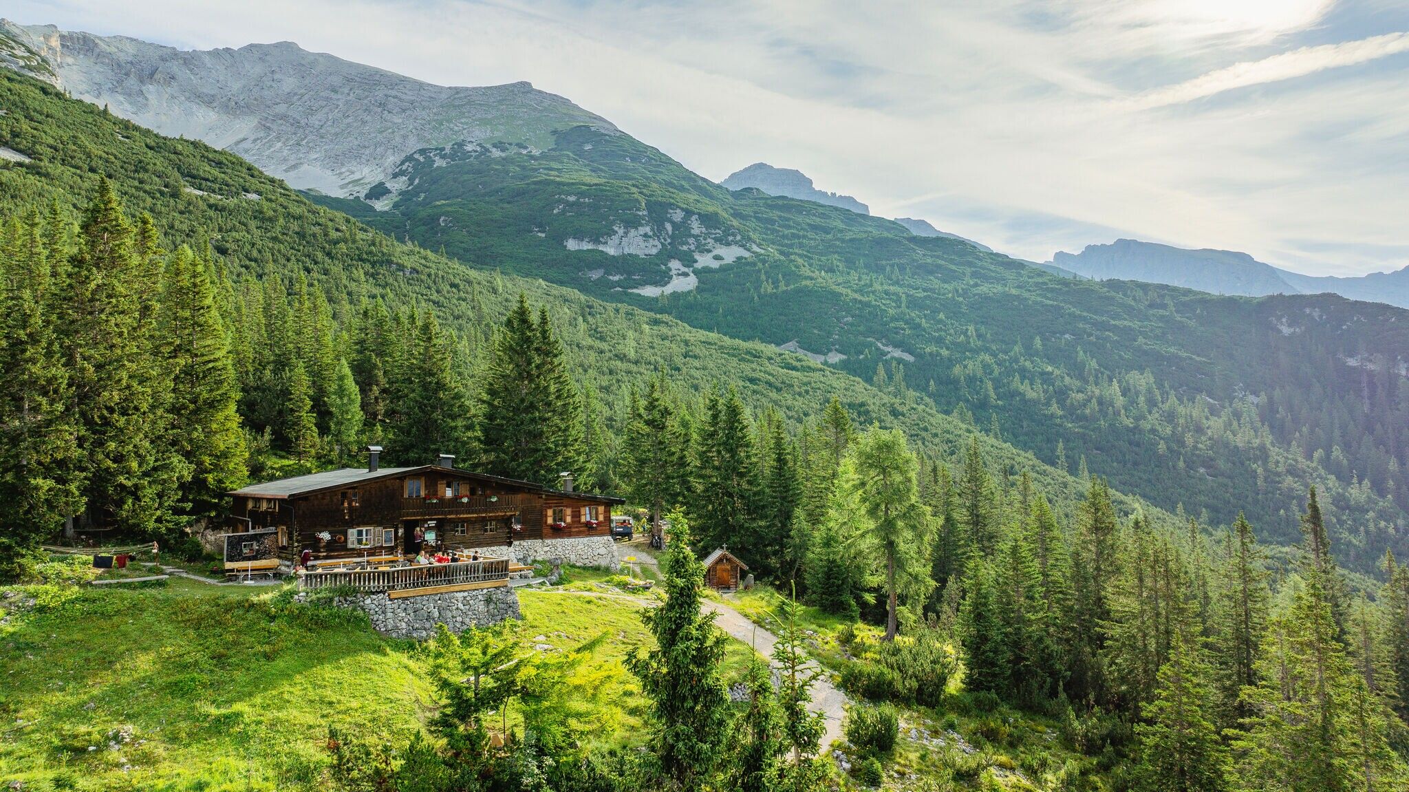
The path flattens out for a short distance (always keep to the right) and then steadily climbs in numerous switchbacks to the Pleisenhütte, which invites you to take a break on its sunny terrace on the south side. Hikers in good shape can continue the ascent to Pleisenspitze (2569 m).
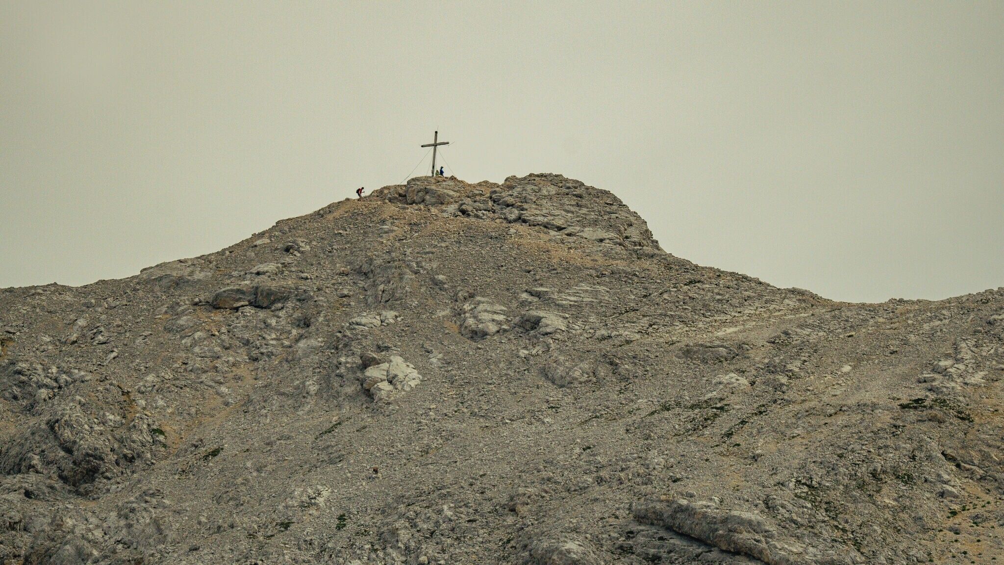
Just behind the hut, a narrow, partly steep trail initially leads through dwarf pines and later over alpine meadows to Pleisenspitze, which offers a spectacular view of the surroundings. The descent is via the same route. Good footing is required!
For those who only want to visit the Pleisenhütte, there is also a detailed tour description: Hike to the Pleisenhütte.
By train to Scharnitz train station, then a 10-minute walk to the starting point at the Nature Park Information Center.
All real-time connections can be found in the route planner.

.jpg")
.jpg")
.jpg")


 Olympiaregion Seefeld")


