
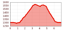
Difficulty:
difficult
Length:
8.3 km
Duration:
3:30 h
Elevation uphill:
498 m
Forest hike Erzherzog-Eugen-Weg
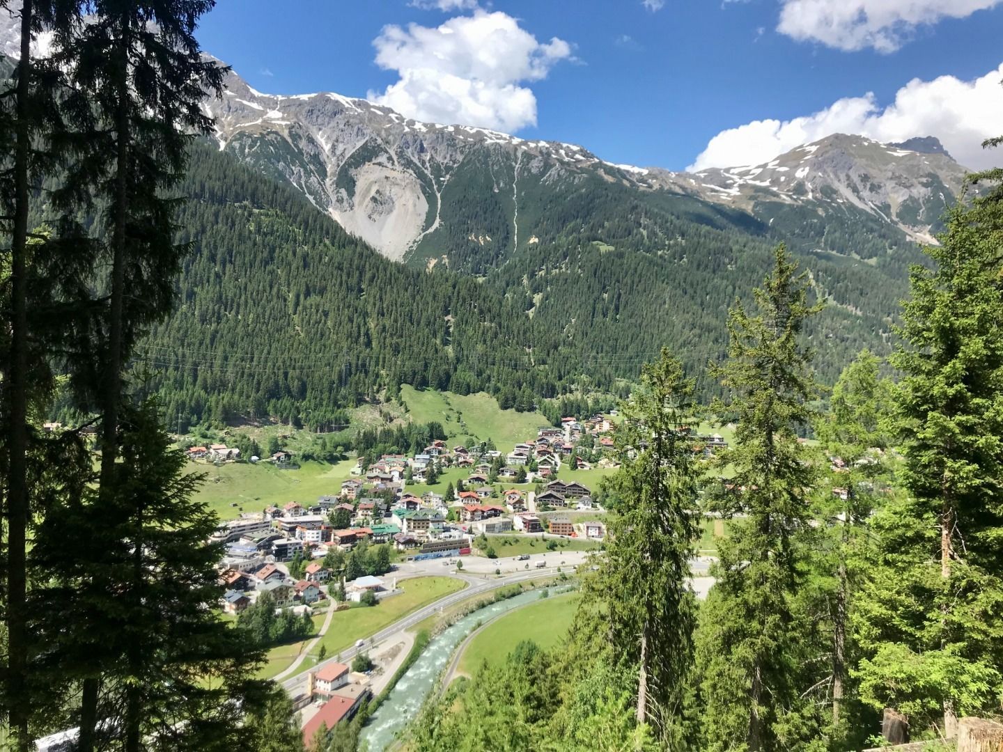
From the starting point Arlberg WellCom, head east along the artmile (“Kunstmeile”) to the Nassereinbahn
lift. Turn right, cross the Dorfstraße and pass the Shell petrol station on the right. Head along the Augweg, take the underpass and then the Aubrücke bridge. Turn right and pass along the graveyard.After 200 m, turn left at the fork (follow the signpost) and take the footpath with switchbacks into the woods until the fork for the Antoniusweg/Erzherzog-Eugen-Weg. Follow the signposts along the switchbacks through the woods up to a roadway. Turn west at the road. After about ten minutes, take the footpath upwards (beautiful path through
the forest). This leads to the Moostal road. Head down the valley and back to town along this trail.


