Mountain hikes Elmen - Over the Neeren to the Stablalm

Elmen /
Difficulty ratings: difficult
Route length: 6.7 km
Duration: 3:30 h

The hike over the Neerengrat ridge always offers the most beautiful views of the Allgäu Alps and the imposing Hochvogel.

Tour information

  • Requirement: difficult
  • Length: 6.7 km
  • Duration: 3:30 h
  • Elevation uphill:735 hm
Highest point 1,714 m

Starting point

Stablalm car park

Finishing point

Stablalm
  • Fitness level 2 / 6
  • Technique 3 / 6

Features

  • Circular route

Best time of year

  • January
  • February
  • March
  • April
  • May
  • June
  • July
  • August
  • September
  • October
  • November
  • December

Trail condition

Gravel, path

Equipment

Good equipment is essential for your hike. The following items should definitely be in your rucksack: - Food and drink - Functional clothing for rain, wind and cold - A change of clothes - Sun protection - First aid kit - Mobile phone with a full battery (Euro emergency number 112) - Hiking map or GPS - Hiking poles Nevertheless, the following applies: light luggage is also easier to carry, so you should not weigh down your rucksack with unnecessary ballast. In addition, your hiking equipment should of course also be adapted to your particular hiking tour.

Description

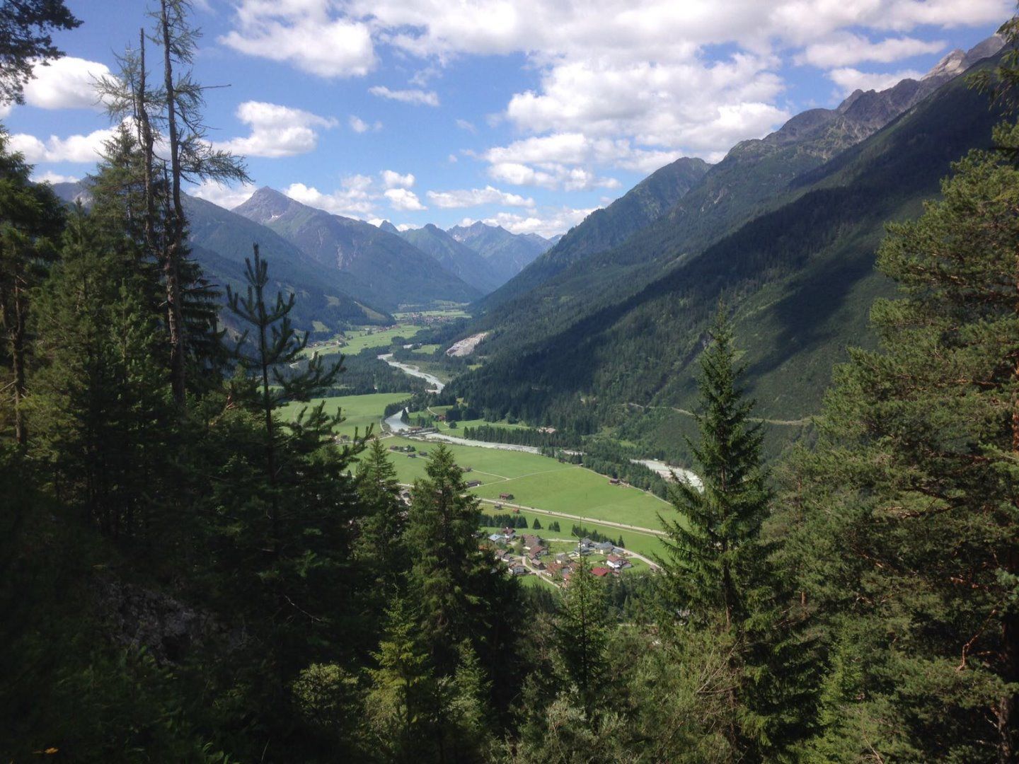
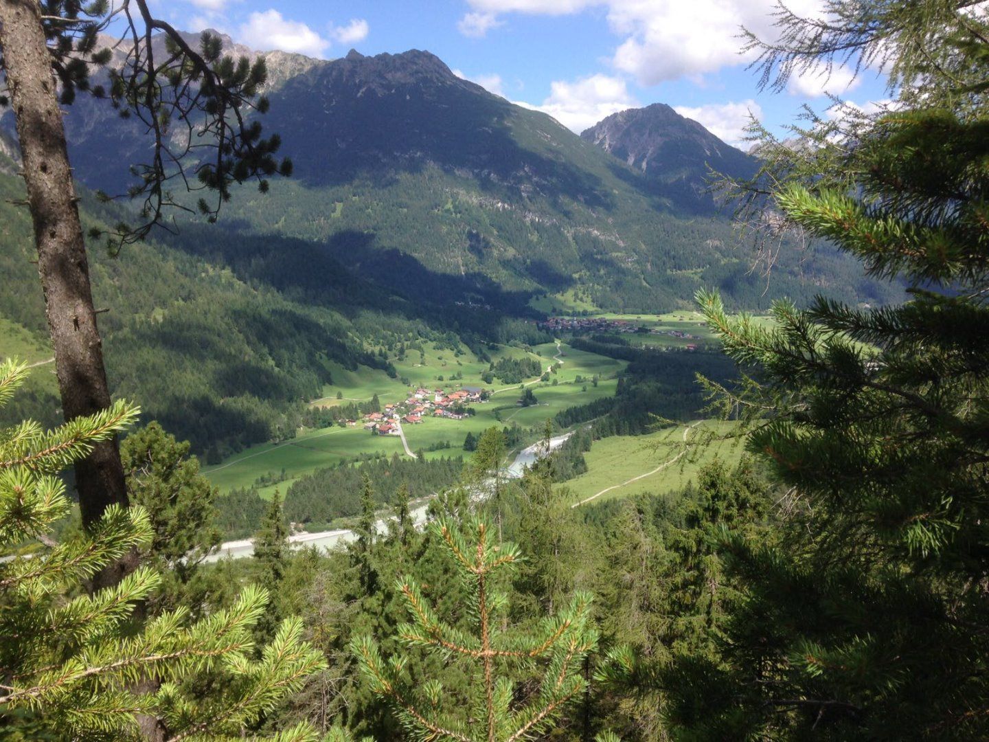
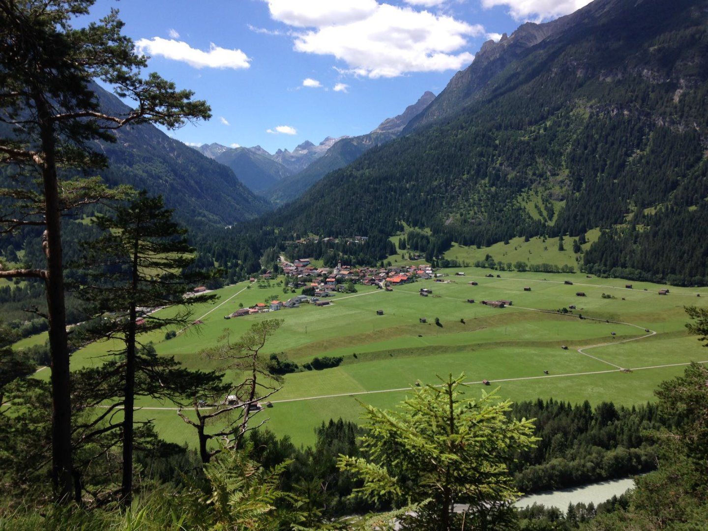
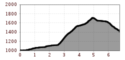
From the Stablalm car park at the upper end of Elmen, follow the gravel road to the "Neerenweg" signpost at the first bend. Now follow the path towards Stanzach until the next signpost "Neerenweg zur Stablalm". The steep climb leads up through sparse high forest to the Neerengrat ridge - only suitable for experienced hikers. At the highest point of your hike, the trail descends through sunny clearings to the Stablalm.

Getting here

  • Parking

    Stablalm car park - for a fee

Weather

More tours in the surrounding area

Newsletter

The mountain is calling? So does our newsletter!

In our weekly newsletter we reveal the best holiday tips for Tyrol.