
Difficulty:
difficult
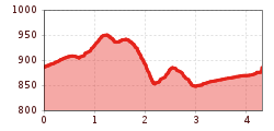
Length:
22.8 km
Duration:
13:00 h
Elevation uphill:
2,650 m
Circular route Wald – Hohenegg – Wald
ATTENTION: The path to the Walder waterfall is currently closed. (Status as of 10.04.2024)
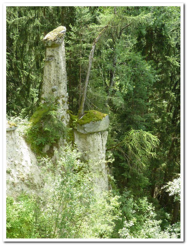
Starting point: Church in the hamlet of Wald. Follow the path to the left of the church. When you reach the first bend, a steep path forks off to the left to the hamlet of Oberwaldried. Continue past the sports grounds and keep left to cross the Walderbach brook to get to the hamlet of Hohenegg (Erdpyramiden, engl. ‘earth pillars‘) For the way back turn left at the chapel and follow a picturesque track to the Walderbach stream, visit the waterfall – the 10 minute detour is well worth it – and follow the country road for the last stretch to return to the starting point.


