Mountain hikes Bach - Baumgartalm

Bach-Stockach /
Difficulty ratings: easy
Route length: 7.4 km
Duration: 3:00 h

An ideal excursion destination for families! Hut not open to the public!

Tour information

  • Requirement: easy
  • Length: 7.4 km
  • Duration: 3:00 h
  • Elevation uphill:614 hm
Highest point 1,661 m

Starting point

Car park behind the community centre in Bach

Finishing point

Baumgartalm
  • Fitness level 2 / 6
  • Technique 2 / 6

Features

  • Suitable for families

Best time of year

  • January
  • February
  • March
  • April
  • May
  • June
  • July
  • August
  • September
  • October
  • November
  • December

Trail condition

Asphalt, Gravel path

Equipment

Good equipment is essential for your hike. The following items should definitely be in your rucksack: - Food and drink - Functional clothing for rain, wind and cold - A change of clothes - Sun protection - First aid kit - Mobile phone with a full battery (Euro emergency number 112) - Hiking map or GPS - Hiking poles Nevertheless, the following applies: light luggage is also easier to carry, so you should not weigh down your rucksack with unnecessary ballast. In addition, your hiking equipment should of course also be adapted to your particular hiking tour.

Description

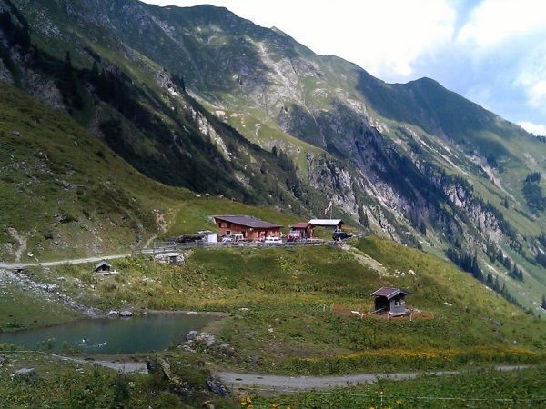
You first hike from Bach in the direction of Madau, after approx. 3 km follow the signpost "Baumgartalm"
On the ascending forest path you walk along the beautiful mountain meadows to the Grießlalm.
The last section is a walk along the mountain stream and pasture to the Baumgartalm.
TIP: Pack a snack!

Getting here

  • Arrival by public transport

    Regional bus stop Bach Dorf

  • Parking

    Community centre in Bach

  • Contact

    Bach - Baumgartalm
    ****

More tours in the surrounding area

Newsletter

The mountain is calling? So does our newsletter!

In our weekly newsletter we reveal the best holiday tips for Tyrol.