
Opening hours:Today closed
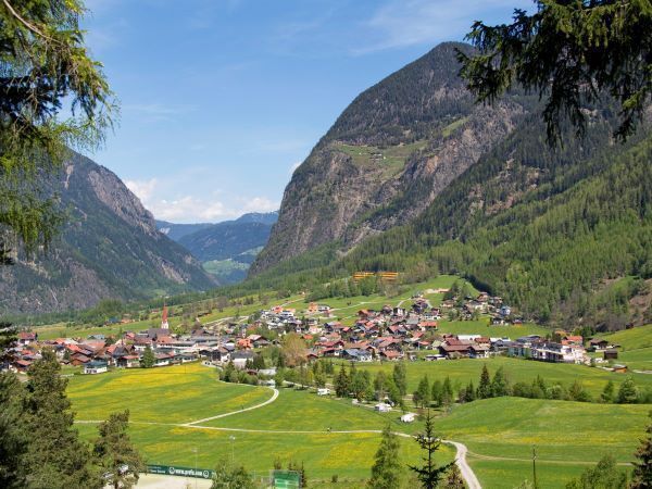
Place:Umhausen
:Restaurant
Umhausen -> Waalweg -> Umhausen
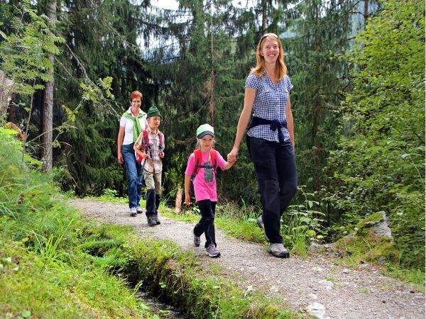
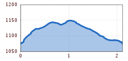
Easy hiking trail; suitable for beginners and walkers
Please check the current weather report at: www.oetztal.com/de/sommer.html
Appropriate equipment such as breathable and weather-adapted outdoor clothing, ankle-high hiking boots, wind, rain and sun protection, hat, possibly gloves, is required for all hikes and routes. It is necessary to carry a first aid kit, a mobile phone, and possibly a hiking map, as well as sufficient provisions if hiking without the possibility of stopping for refreshments.The hike begins at the Bischoffsplatz parking lot. To the right of the Kneipphäusl snack station, the path leads up into the Tauferberg forest. At the top, a flat path branches off to the left – you are on the Waalweg. Directly beside the flat high path runs a small stream, which was formerly used to irrigate the fields. You can also find one or two waterwheels here. Follow the path until you reach the normal road again, which leads back to the starting point.
Travel comfortably and safely by train to the Ötztal train station. The final stop or exit point is the ÖTZTAL station. Afterwards, you can conveniently and quickly travel by public transport or local taxi companies through the entire valley to your desired destination.
The current bus schedule is available at: fahrplan.vvt.at
The following parking options are available in Umhausen:


")


