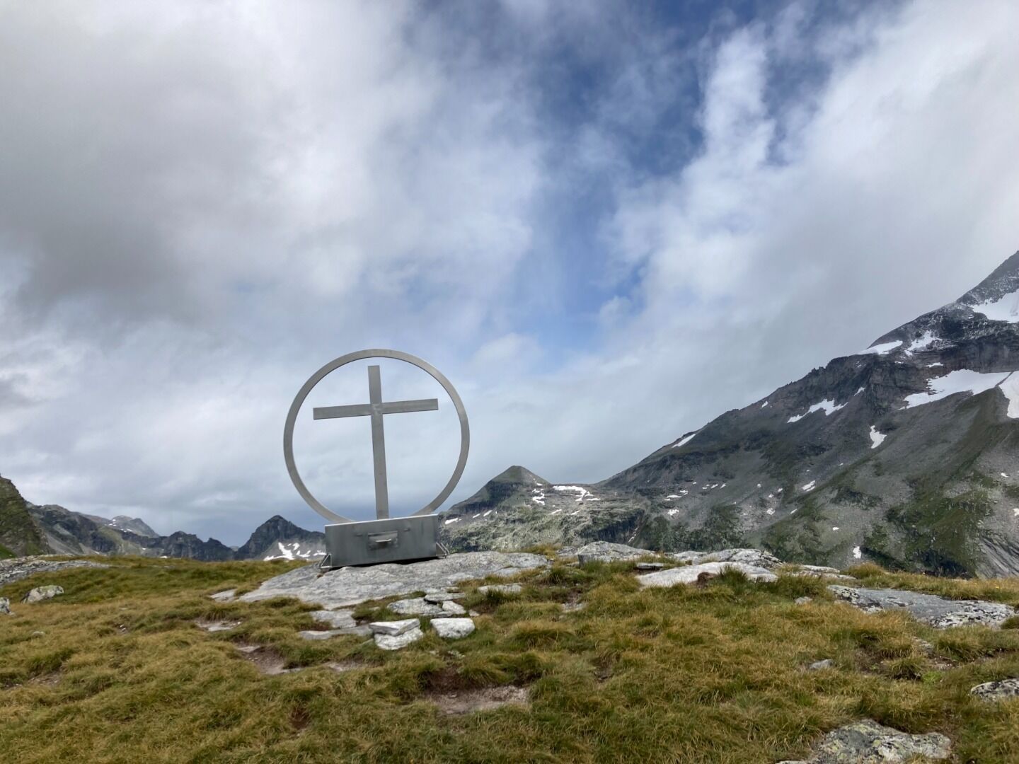
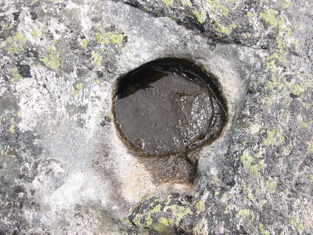
The world comes full circle at the Spinevitrol summit cross, which connects earth and sky, past and present. The place of power was an ancient place of worship, as the bowl stones carved into the rock suggest.
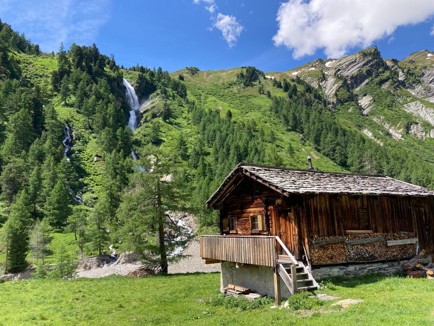
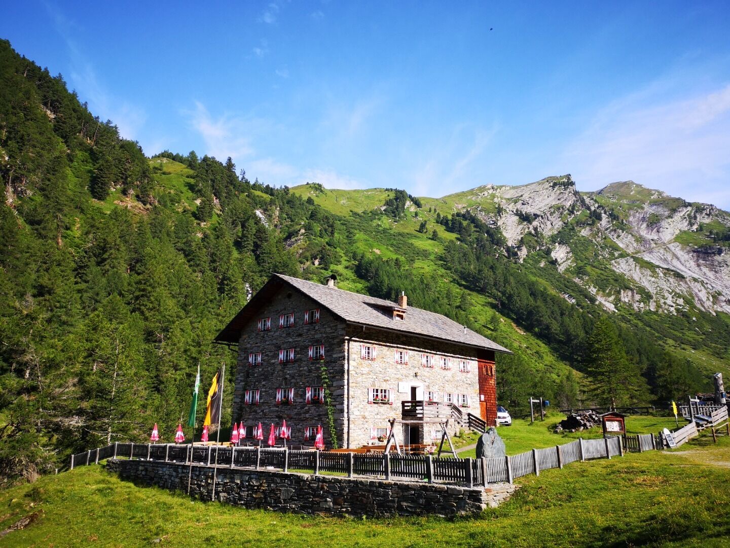
The East Tyroleans are high up. Even the Spinevitrol, which is towered over by the surrounding peaks, reaches 2,483 meters. From the Kalser Tauernhaus, which regards it as its local mountain, you hike up to the Spinevitrolkopf via the path next to the Stotzbach waterfall. Experienced hikers can reach the summit on this route in around 2.5 to three hours. Tired? Then the "place of power", which is reminiscent of a Tibetan plateau, is just what you need. The Spinevitrol is passed on the Glocknerkrone long-distance hike. Of course, this outstanding summit can also be reached as a day tour from the valley.
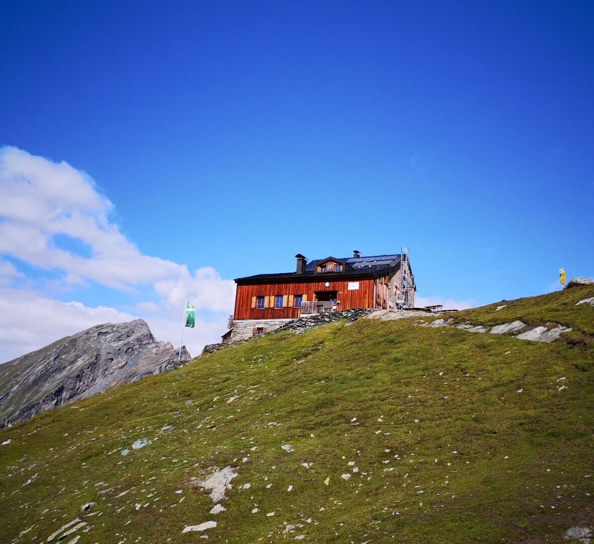
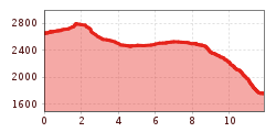
The 2. stage starts from the Sudetendeutschen Hütte with an ascent to the highest point of the day the Gradötzsattel (2.826 meter).
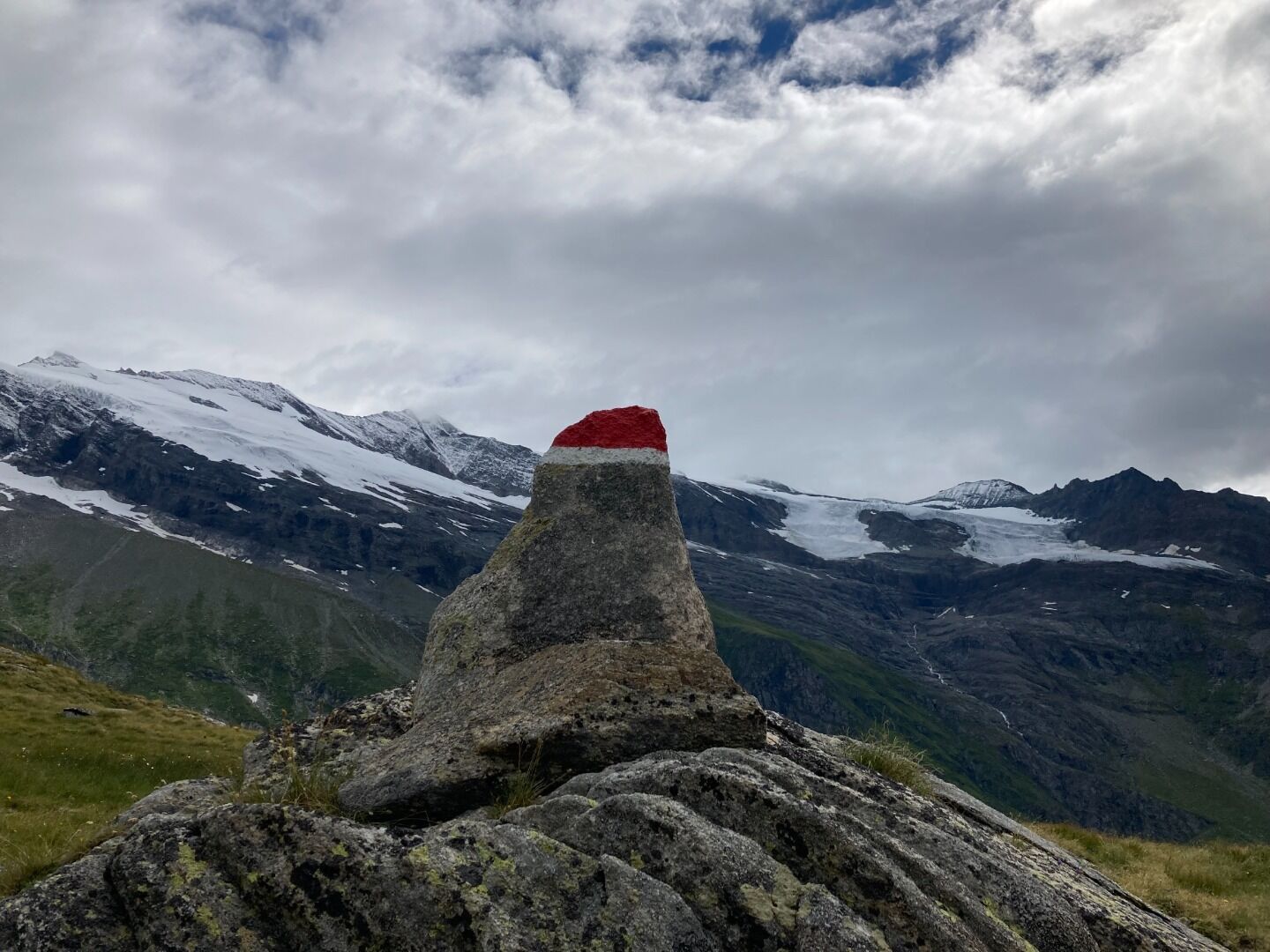
Downwards the hiking path passes rocks, boulders and mountain streams. At an altitude of 2.500 meter follow the left turn northward to the Silesiaweg, AV 517, into an extensive pastureland until you reach the mountain lake Schwarzsee. Afterwards you reach the nature powerspot Spinewitrol with it's prominent cross on the summit. Take the path AV 514A to climb down by passing alpine meadows at the Hintere Ochsenalm to the hiking path AV 514. The last steep slope leads you next to the Waterfall of the "Stotz", a stone pine forest and a shrub vegetation to the end of the stage at the Kalser Tauernhaus (1.755 meter).


www.bergpixel.de")


