From mountaineering village to mountaineering village - stage 1 From mountaineering village to mountaineering village - stage 2 From mountaineering village to mountaineering village - stage 1 From Mountaineering Village to Mountaineering Village
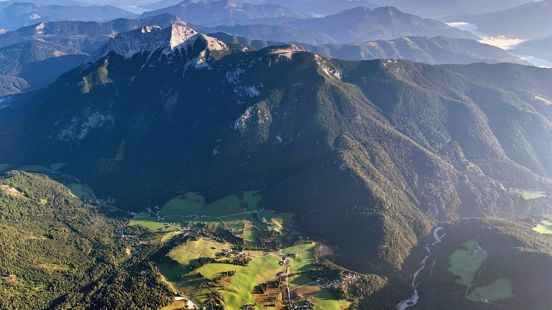
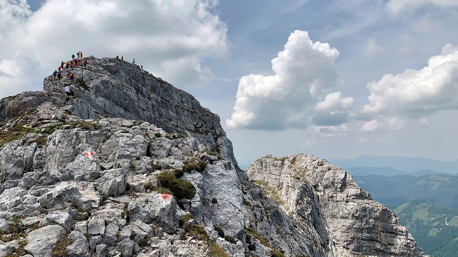
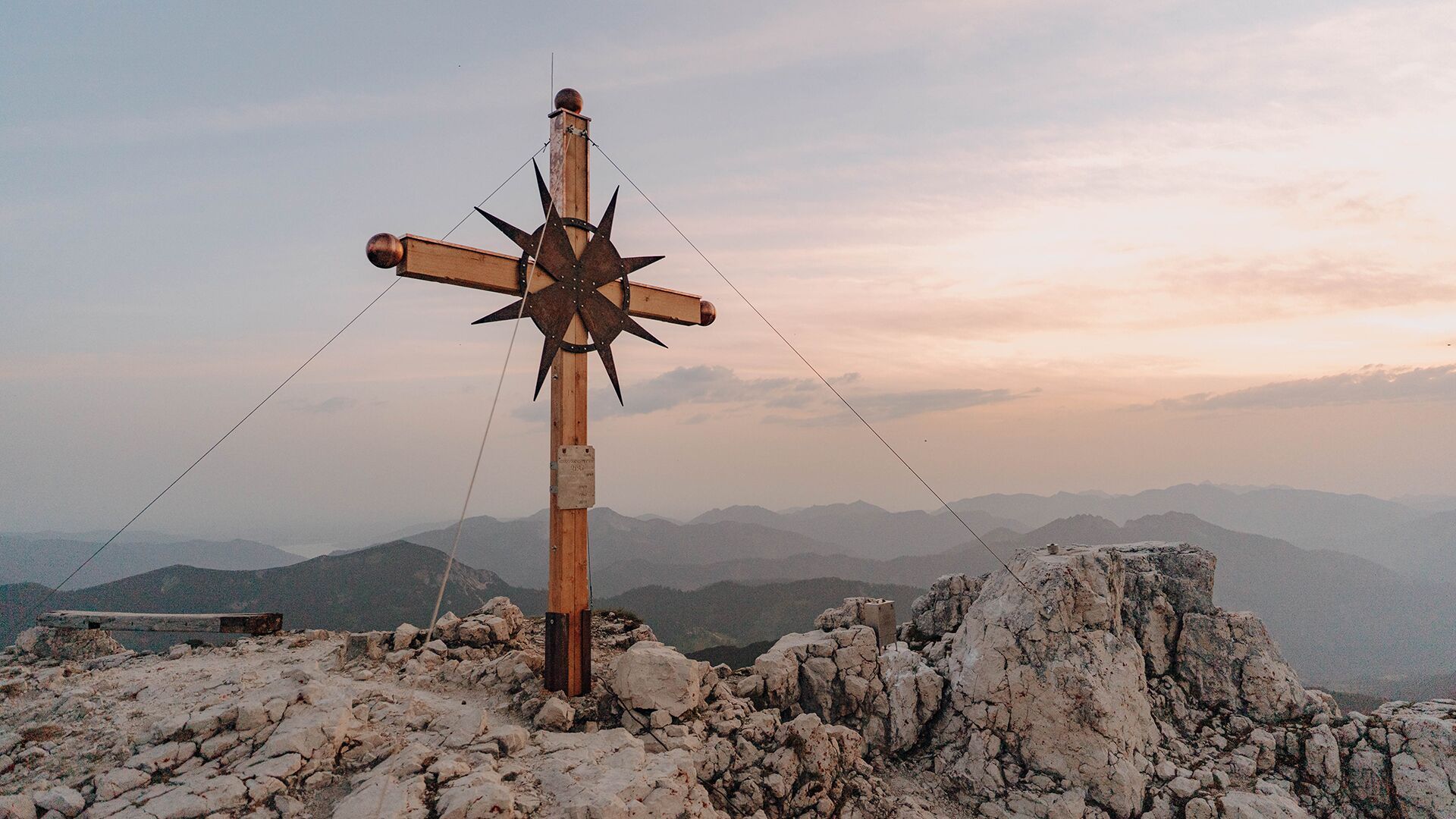
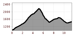
DescriptionStage 1: Steinberg am Rofan, Gasthof Waldhäusl (1,015m) - Guffert (2,195m) - Issalm - Schneidjoch (1,811m) - Gufferthütte (1,475m, Refreshment & overnight stay)
Adaptive cross-country skiing trail in Eben am Achensee (M2)Opening hours: closed Difficulty: easy Length: 4.5 km Duration: 1:00 h Elevation uphill: 94 m : Style: Classic Go to Cross-country skiing trailMore about Adaptive cross-country skiing trail in Eben am Achensee (M2)
Achenkirch - Falkenmoosalm - Großzemmalm - Juifen - AchenkirchDifficulty: medium Length: 20.5 km Duration: 7:30 h Elevation uphill: 1,120 m See trailMore about Achenkirch - Falkenmoosalm - Großzemmalm - Juifen - Achenkirch
Dalfazer FallsDifficulty: medium Length: 9.2 km Duration: 4:00 h Elevation uphill: 760 m See trailMore about Dalfazer Falls
Eagle Walk Stage 07: Jausenstation Waldhäusl - Erfurter HütteDifficulty: difficult Length: 18.0 km Duration: 7:00 h Elevation uphill: 1,590 m See trailMore about Eagle Walk Stage 07: Jausenstation Waldhäusl - Erfurter Hütte
Bergstation Rofan Seilbahn - Rofanspitze - Bergstation Rofan SeilbahnDifficulty: medium Length: 7.1 km Duration: 3:30 h Elevation uphill: 485 m See trailMore about Bergstation Rofan Seilbahn - Rofanspitze - Bergstation Rofan Seilbahn
Steinberg - Schneidalm - Raetische Inschriften - Gufferthütte - SteinbergDifficulty: medium Length: 18.1 km Duration: 8:00 h Elevation uphill: 1,060 m See trailMore about Steinberg - Schneidalm - Raetische Inschriften - Gufferthütte - Steinberg
Steinberg - PanoramarundeDifficulty: easy Length: 6.1 km Duration: 2:00 h Elevation uphill: 200 m See trailMore about Steinberg - Panoramarunde
Bärenwald circuitDifficulty: easy Length: 4.8 km Duration: 1:30 h Elevation uphill: 180 m See trailMore about Bärenwald circuit
Steinberg - Gfaßsattel - Kotalm - Vorderunnutz - Kögljoch - Schönjochalm - SteinbergDifficulty: difficult Length: 18.2 km Duration: 7:30 h Elevation uphill: 1,030 m See trailMore about Steinberg - Gfaßsattel - Kotalm - Vorderunnutz - Kögljoch - Schönjochalm - Steinberg
Steinberg - Gaismoosstollen - SteinbergDifficulty: medium Length: 5.5 km Duration: 2:00 h Elevation uphill: 210 m See trailMore about Steinberg - Gaismoosstollen - Steinberg
Steinberg - Guffert - SteinbergDifficulty: difficult Length: 10.3 km Duration: 6:30 h Elevation uphill: 1,195 m See trailMore about Steinberg - Guffert - Steinberg
Achenkirch - Köglalm - Kotalm Mitterleger - Kotalm Niederleger – AchenkirchDifficulty: medium Length: 9.6 km Duration: 5:00 h Elevation uphill: 720 m See trailMore about Achenkirch - Köglalm - Kotalm Mitterleger - Kotalm Niederleger – Achenkirch
Achenkirch - Geopfad Obere Ampelsbach- und Filzmoosbach Schlucht - Gufferthütte - AchenkirchDifficulty: medium Length: 15.2 km Duration: 4:30 h Elevation uphill: 490 m See trailMore about Achenkirch - Geopfad Obere Ampelsbach- und Filzmoosbach Schlucht - Gufferthütte - Achenkirch
Adaptive cross-country skiing: accessible trail in Maurach am AchenseeOpening hours: closed Difficulty: easy Length: 4.0 km Duration: 1:00 h Elevation uphill: 21 m : Style: Skating, Classic Go to Cross-country skiing trailMore about Adaptive cross-country skiing: accessible trail in Maurach am Achensee
M5 - Panorama trailOpening hours: closed Difficulty: medium Length: 3.5 km Duration: 1:00 h Elevation uphill: 85 m : Style: Skating, Classic Go to Cross-country skiing trailMore about M5 - Panorama trail
Dalfaz AlmDifficulty: medium Length: 10.5 km Duration: 4:30 h Elevation uphill: 840 m See trailMore about Dalfaz Alm
Accessible cross-country skiing Achenkirch am Achensee village trail (A3)Opening hours: closed Difficulty: easy Length: 10.0 km Duration: 2:00 h Elevation uphill: 99 m : Style: Skating, Classic Go to Cross-country skiing trailMore about Accessible cross-country skiing Achenkirch am Achensee village trail (A3)
A4 - Oberautal lake trailOpening hours: closed Difficulty: easy Length: 7.0 km Duration: 1:30 h Elevation uphill: 138 m : Style: Skating, Classic Go to Cross-country skiing trailMore about A4 - Oberautal lake trail
Adaptive cross-country skiing trail in Buchau am Achensee (M1)Opening hours: closed Difficulty: easy Length: 2.0 km Duration: 0:30 h Elevation uphill: 14 m : Style: Skating, Classic Go to Cross-country skiing trailMore about Adaptive cross-country skiing trail in Buchau am Achensee (M1)
13 Zillertal Cycle PathDifficulty: easy Length: 36.4 km Duration: 2:00 h Elevation uphill: 120 m Go to biketourMore about 13 Zillertal Cycle Path
Fuchs Brand trail - A1Opening hours: closed Difficulty: difficult Length: 6.0 km Duration: 1:00 h Elevation uphill: 164 m : Style: Skating, Classic Go to Cross-country skiing trailMore about Fuchs Brand trail - A1
Give feedback for a chance to win a special holiday experience!Click here for the surveyClick here for the survey