Simmering (629)

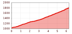
Great MTB panoramic tour for the high summer: On the way to the high-altitude Simmering Alm, you can refresh yourself at the Zwischensimmering Vorplateau at Trendlbach. The route is simple: From the Grünberg parking lot, follow the forest road towards Simmering until the forest road branches off to the right at Zwischensimmering towards Simmering. In numerous hairpin bends, the path leads up through pine forests to the Alm. The return is on the same route.
Highlights: Great views of the Mieminger Chain, the Upper Inn Valley, and the Karwendel.