singletrack Enduro Goldegg - K

Sölden /
Difficulty ratings: difficult
Route length: 16.5 km
Duration: 3:30 h

The 16.5 km long Enduro Goldegg route is considered the classic among the BIKE REPUBLIC citizens. 

Tour information

  • Requirement: difficult
  • Length: 16.5 km
  • Duration: 3:30 h
  • Elevation uphill:837 hm
  • Elevation downhill:837 hm
Highest point2,180 m

Starting point

Freizeit Arena

Finishing point

Freizeit Arena
  • Fitness level 5 / 6

Best time of year

  • January
  • February
  • March
  • April
  • May
  • June
  • July
  • August
  • September
  • October
  • November
  • December

Equipment

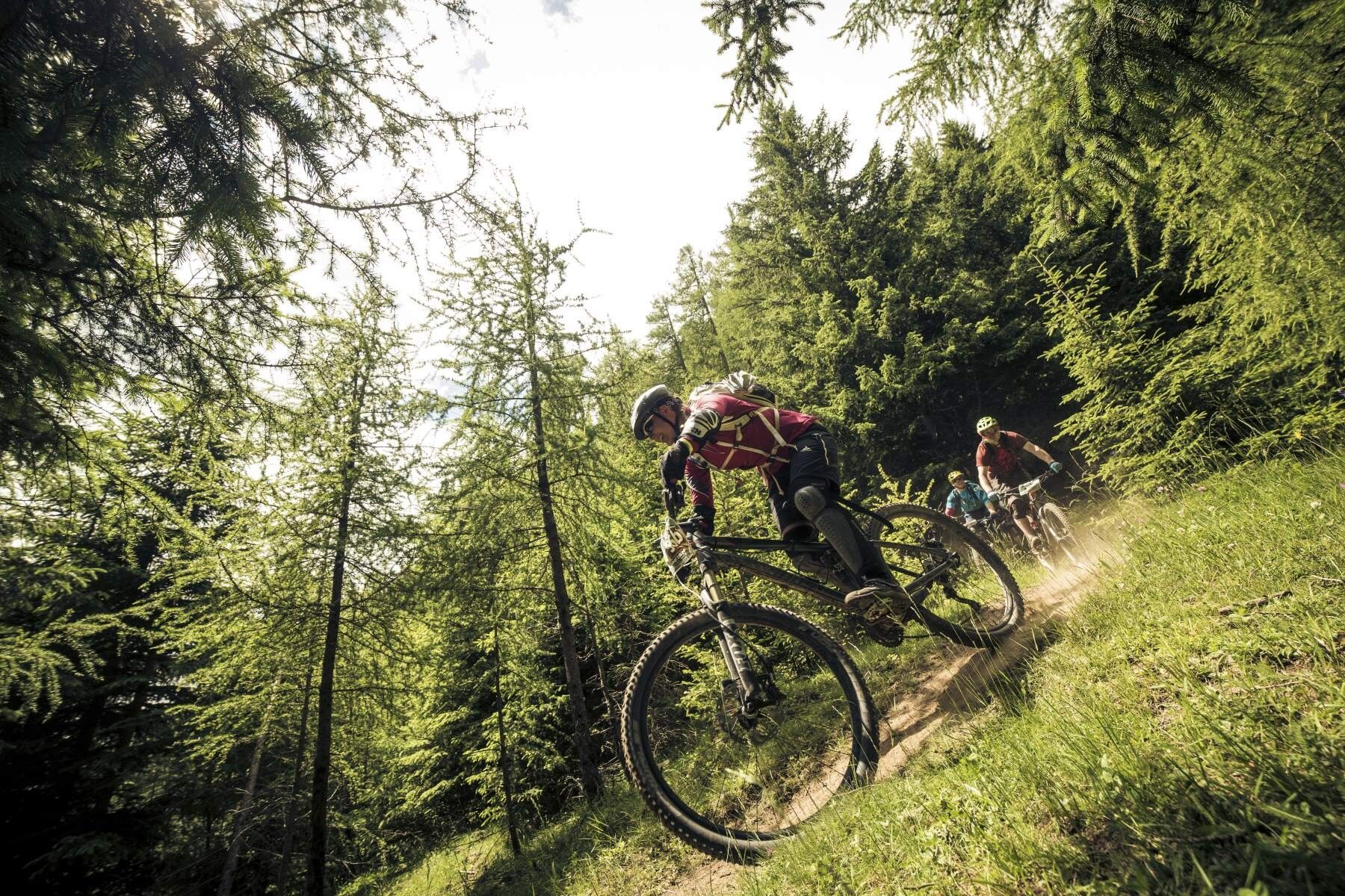
The Nene Trail is a black natural trail that is really extremely tricky. Only for technically very skilled riders!

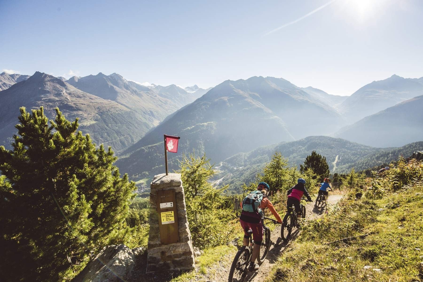
In the BIKE REPUBLIC SÖLDEN, it’s about shared fun in bike sports – regardless of your skill level. Be considerate of each other and support each other. Also, behave respectfully towards all other people on the mountain and in the valley – and towards nature.

–> Stay on the paved and signposted paths. Do not ride over open meadows!

–> Avoid blocking the rear wheel and thus help to maintain the trails.

–> Be considerate of animals & close the pasture gates. There can always be cows on the trails and lines. Ride accordingly carefully and keep your distance! 

–> Please note: Hikers are also on the natural trails of BIKE REPUBLIC SÖLDEN. Ride carefully, stop, give way considerately, and greet nicely. 

Well-equipped rules! We recommend wearing MTB protective gear (helmet, protectors for knees, elbows, back, ...) on all lines, trails, enduro routes, and mountain bike routes of BIKE REPUBLIC SÖLDEN. All routes are exclusively designated for use with mountain bikes that meet today's quality standards.
Source: Ötztal

Description

The start and finish point of the Enduro Goldegg Tour K is the Freizeit Arena in the center of Sölden. Facing the Freizeit Arena, start to the right and follow the Ötztal Radweg 11 to the valley station of the Gaislachkogelbahn. Upon arrival at the Gaislachkogelbahn, turn right to reach the federal highway B186; follow it until the junction to the Glacier Road from the federal highway. From here turn right and ride the steep Glacier Road uphill; after two hairpin bends leave the Glacier Road and follow left the Infangstraße towards Gaislach/Silbertal. It’s best to stick to the Gaislach Route (644). Through forest and over the meadows of the Gaislachalm, passing three places to eat (Sonneck, Gaislach & Heidealm) up to the highest point of the tour, the Nene Trail, which starts shortly before the middle station of the Gaislachkoglbahn at 2,170 m. The trail entry is marked by a cairn. 

The black Nene Trail is a very demanding, challenging trail: the (super scenic) upper section is often wet and slippery; in the forest it gets tricky with big roots and rocky sections. It finally leads to the BROATE LINE or the Schteckler Trail, which lead down to the Pumptrack ROLLIN into the valley. 

Please watch out for hikers!


Getting here

  • Arrival by public transport

    Arrival by train

    Take the train easily to Ötztal Bahnhof at the valley entrance. A scheduled bus to Obergurgl departs directly from the station forecourt. The bus ride to Sölden takes approximately 1 - 1.5 hours. On the designated bike buses, bike transport (including eMTBs) is free with a valid bus ticket.

    All important information about bus schedules, connections, and taxi companies can be found here.

  • Parking

    At the valley station of the Gaislachkoglbahn and the Giggijochbahn, there are enough parking spaces available; there are also parking garages.

    The parking spaces are subject to a fee.

    Paid overnight parking of cars is possible in the Gaislachkogl parking garage:

    more information about overnight parking

More tours in the surrounding area

Newsletter

The mountain is calling? So does our newsletter!

In our monthly newsletter we reveal the best holiday tips for Tyrol.