Via ferrata Seeben Klettersteig

Ehrwald
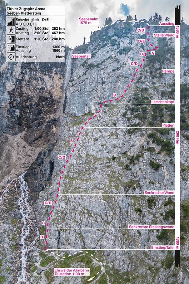
Difficulty ratings: D/E
Duration: 1:00 h
Altitude: 200 hm

- Sporty, very exposed challenge - At the Seebenbach waterfall - Close to the valley and easy to reach

We recommend because

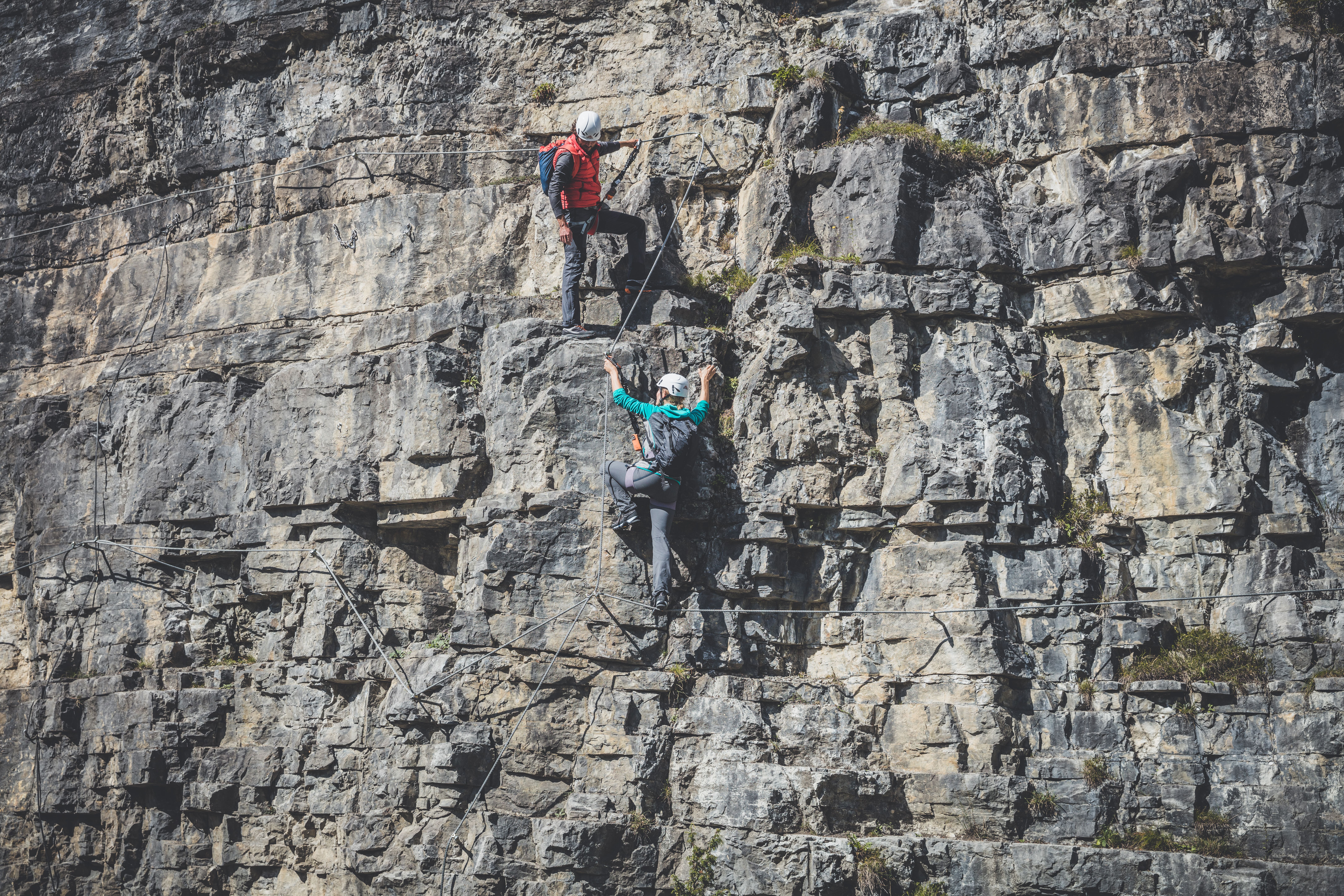
Exposed via ferrata for professionals near the valley at Seebenfall. You need a lot of strength and climbing experience to master this route through the Seeben walls, which is almost entirely steep and graded D/E. Even the steep and rockfall-prone D-level entry wall shows what is required. The vertical "stopper slab" at the exit (D/E) takes its final toll after an hour of climbing. Not recommended in the rain, the waterfall alone can cause problems. Secured with lots of footholds and pins. Unsuitable for children. Access from the Ehrwalder Almbahn valley station. Experienced climbers sometimes use the route as the first section of the Ehrwald via ferrata circuit.

Information

  • Requirement: D/E
  • Duration: 1:30 h
  • Duration: 1:00 h
  • Elevation difference: 200 hm
Sea level starting point1110 m
Sea level approach1360 m
Sea level highest point1560 m
Sea level end point1560 m

Approach

From the Ehrwalder Almbahn via the waterfall circular trail, towards the via ferrata

Descent

Via Immensteig or Hoher Gang

Walking time descent

2:00 h

Best time of year

  • January
  • February
  • March
  • April
  • May
  • June
  • July
  • August
  • September
  • October
  • November
  • December

Route description

A very beautiful, exposed via ferrata that requires strength and skill. The climb is not suitable for children.

A modern via ferrata close to the valley, which has been perfectly renovated and offers a daring, challenging route through the Seebenwände next to the waterfall.

The approach from the valley station of the Ehrwalder Almbahn is easy, as is the descent via various well-marked mountain paths.

The 'Seebener' can also be considered the first section of the Ehrwald via ferrata circuit.

Due to its proximity to the waterfall, the Seeben via ferrata is extremely difficult in wet conditions. Also watch out for falling rocks: put on your helmet as soon as you approach below the walls. The climb was renovated again in 2007 and additional footholds are now provided at the start.

Descent
After the exit, continue on the path to the Seebenalm (approx. 10 min.). From there there are several options for descending or continuing:
- From the Seebenalm on the forest path to the Seebensee (1657 m) (approx. 30 min.). From the northern end of the Seebensee, at the bridge, the marked trail “Hoher Gang” branches off. The Hoher Gang is a narrow, steep path that is partially secured with a steel cable. At the end of the Hoher Gang, turn right at a fork in the path, then briefly uphill to a forest road. Follow this downhill to the valley station (from Seebenalm approx. 1.5 hours).
- From the Seebenalm, follow the forest road to the Ehrwalder Almbahn mountain station, then descend or walk back to the starting point (approx. 1 hour to the Ehrwalder Almbahn mountain station).
- From the Seebenalm, follow the forest path for 1.5 km in the direction of the Ehrwalder Almbahn mountain station. Then follow the signs to the left in the direction of Immensteig (approx. 50 min.).

Descent routes
From the Seebenalm via the Hoher Gang, approx. 1.5 hours.
From the Seebenalm via the Ehrwalder Almbahn mountain station, approx. 1 hour.
From the Seebenalm via the Immensteig, approx. 1 hour.
Getting here

  • Arrival by public transport

    Summer & winter bus of the Tiroler Zugspitz Arena (free with guest card), Postbus (free in the region with guest card), excursion bus Bavaria-Tyrol (only for TZA guests and free with guest card), regional trains (Garmisch-Patenkirchen-Grainau-Ehrwald-Lermoos-Reutte), special bus to Lumagica-Ehrenberg Reutte (free with guest card, winter only, Sundays only)

  • Parking

    Ehrwalder Almbahn valley station

  • Contact

    WINTERSPERRE - Seeben Klettersteig
    ****

Newsletter

The mountain is calling? So does our newsletter!

In our monthly newsletter we reveal the best holiday tips for Tyrol.