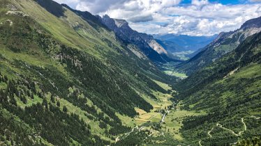
A train from Innsbruck to the top of a mountain? Well, not quite, but this hike at least gives hikers a head start by completing half of the total vertical metres using public transport. It's then just a short walk to the peak where fabulous 360-degree views await. The Padauner Kogel mountain lies in the middle of the Wipptal Valley between Steinach am Brenner and the Brenner pass. The treeless, grass-covered summit offers a panorama including famous mountains like the Olperer as well as the Brenner pass itself, the Stubai Alps and Innsbruck in the distance. On the way down we recommend stopping off at the Gasthof Steckholzer in Padaun.

Summit Hike
Starting point
Railway station St. Jodok
Hike to
Padauner Kogel
Finishing point
Railway station St. Jodok oder Padaun
Mountain chain
Tux Alps
Length
12.3 km
Total hiking time
5 h 30 min
Features
- Wheelchair-accessible Hiking Route
- Circular hike
Difficulty rating
intermediate (red mountain trails)
Altitude
Elevation uphill 936m
Vertical metres downhill 936m
Fitness level
Technique
Best time of year
* These are approximate values and recommendations. Please take your personal fitness level, technical ability and the current weather conditions into account. Tirol Werbung cannot guarantee that the information provided is correct and accepts no liability.
Public transport
- Accessible using public transport
- "S-Bahn Linie 3" trains run once an hour between Innsbruck and Brenner, stopping at the railway station St. Jodok where this hike begins.
- The Guest Card for the Wipptal Valley gives holders free use of public transport throughout the region all the way to Innsbruck.
Parking
Parking available in St. Jodok
Places serving food & drink
- Gasthof Steckholzer in Padaun
Downloads
Trail description
Leaving from the railway station in St. Jodok, head in the direction of the village centre. Take the Kirchsteig trail between the Gasthof Lamm and the bank to the last farm, where the road joins a forest path. Continue into the valley on a gentle incline until the signs indicate the turn-off to the right onto a forest path. Follow this until the fork at Padaun/Padauner Kogel. Turn right here and follow the slightly steeper forest track. After around 30 minutes you will come to a fork, where you have the option of following the path to the left directly to Padaun. Instead of taking this, you need to continue right towards Padauner Kogel. Once you arrive at a small clearing, you only have to negotiate the grassy hump of the Kogel via a few hairpin bends and the summit cross is already in sight. The descent is either via the same path as the ascent or via path number 82, which leads around the Padauner Kogel to Padaun. You first walk over the wide ridge between Vals and Gries am Brenner, then through the forest in an arc below the summit. At the crossroads, continue eastwards towards the Gasthaus Steckholzer inn in Padaun. The last section leads through alpine pastures and across a meadow with a short ascent up to the Gasthaus Steckholzer, where you can stop for a bite to eat.


